
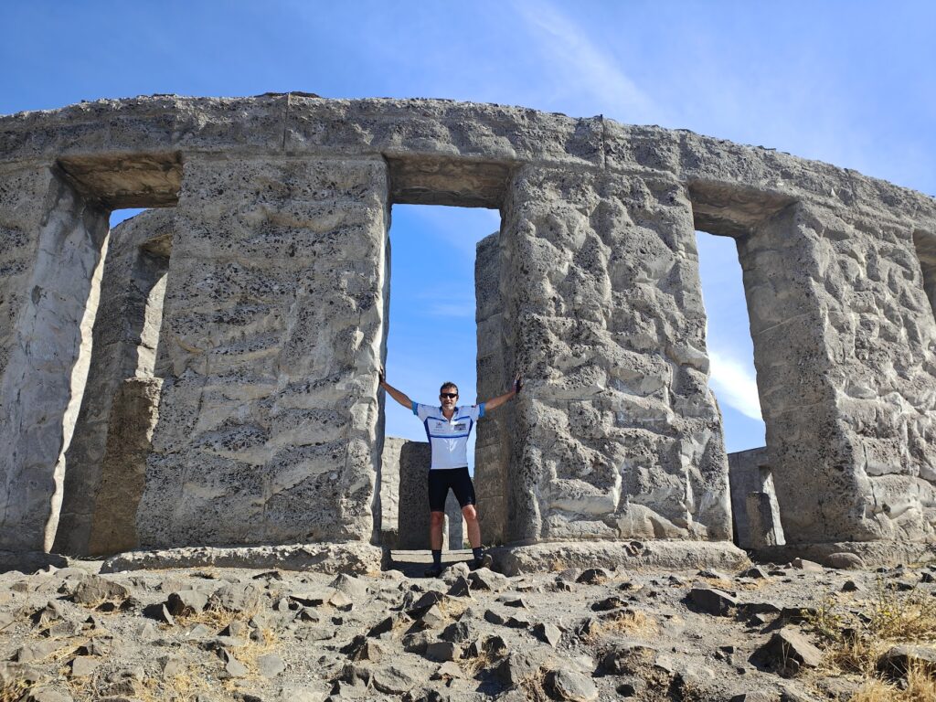
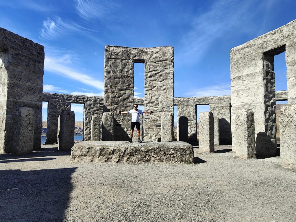
Today was a day of several different parts that were all, in their own way, very memorable. I began, a little later than I had hoped, by crossing the Columbia River back into Washington and climbing up from the riverside village of Maryhill to Stonehenge. Well, a full size replica of Stonehenge at any rate. It stands up on a high bluff overlooking the river and was erected as the nation’s first WW1 memorial, in honour of the servicemen of Klickitat County who died in service. It is built from reinforced concrete after the local stone proved unsatisfactory. The position of the altar stone was fixed during a total eclipse of the sun in June 1918. This was about as bizarre a start to my day as I could have imagined; but it made for some great final views of the gorge before I climbed up higher to the northeast.
Google maps played more tricks on me today; but I have forgiven it because they brought about some amazing experiences. After Stonehenge, it told me to take Maryhill Loops Road up to the very top of the river valley bluff, a good stiff climb of 850 feet. The signs by the turning said it was a dead end; but Google maps said otherwise. It looked interesting and was accessible through a narrow pedestrian gate, so I gave it a go. This “historic road” was once the only link between the Columbia River and the town of Goldendale, WA to the north. The lower stretches of the road are well preserved and I had it completely to myself as I climbed through 25 curves, 8 of which are hairpins. It loopeth muchly, keeping the gradient to under 5%. But then it stops. The road reached a viewpoint, by a spring with a drinking trough and a bench, and that was it. Almost. It carried on quite a lot further in much rougher condition before reaching a locked set of gates. Since there were signs on the other side of these gates telling people from above not to enter, I surmised I would be fine once I got over, which required nothing more than removing my panniers and lifting them and my bike above the obstruction. As it happened, this manoeuvre had to be repeated near the top; but I made it and had to give Google maps a little credit, even if it wasn’t strictly the right thing to do.
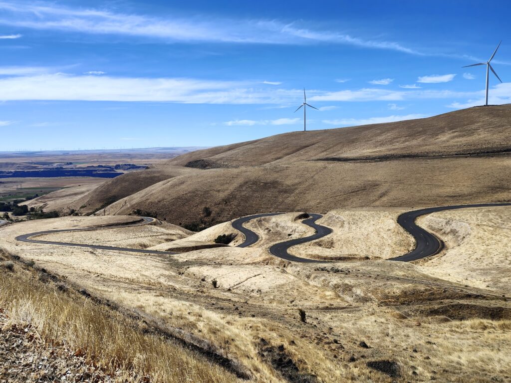
Loopy
Joining in with the main US 97 highway, I climbed over the final hump to be presented with a stunning view of Mount Adams in front of me across the golden plains. A nearby viewpoint said this majestic snow-capped volcano, not unlike Mount Hood in appearance, was 45 miles away. Mount Hood, also visible, was now 50 miles behind me. You could even just make out the white summit of Mount Rainier, 85 miles away, such was the vastness of the landscape and blueness of the sky.
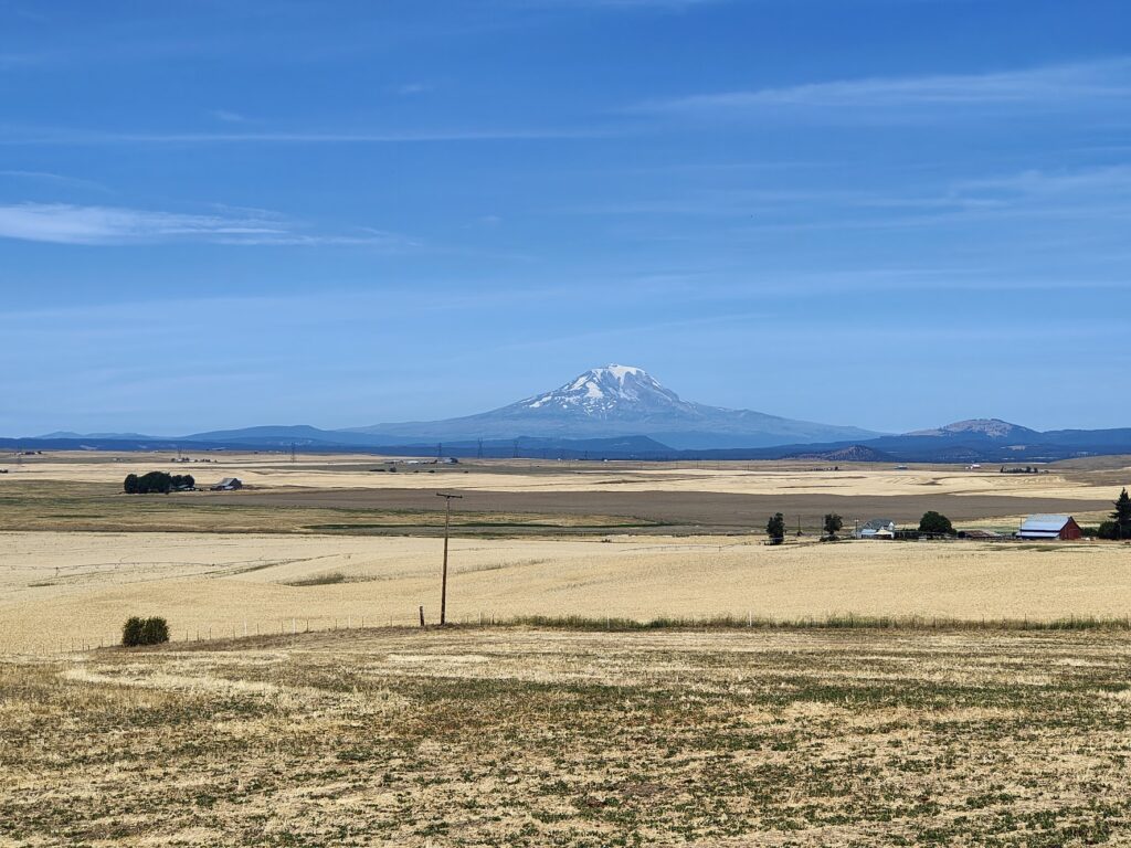
Mount Adams
I cycled on into Goldendale, a small town known for its dark, starry skies and observatories. The town itself was very sleepy but offered my final chance of sustenance for hours to come. Wisely, I stopped and enjoyed an enormous breakfast burrito. How glad I would be of that in 30 more miles.
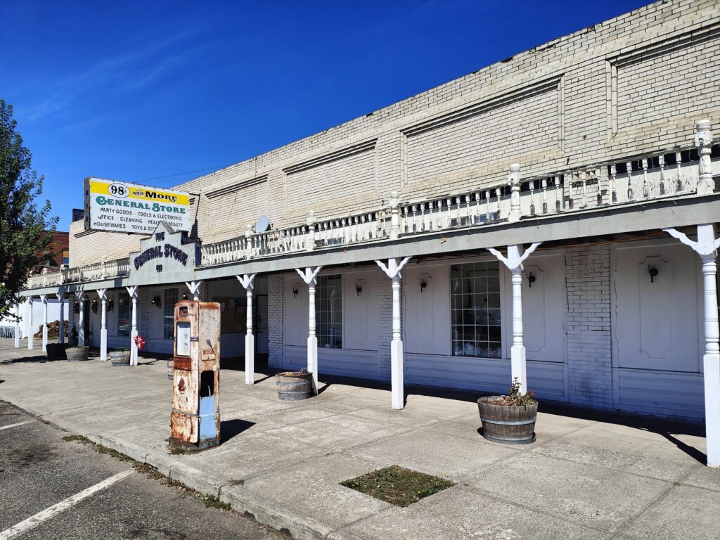
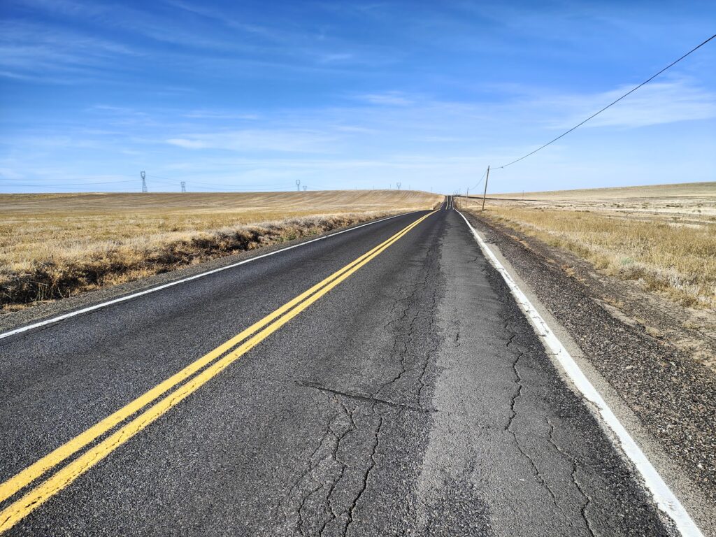
The Main Street headed east and became the Bickleton Highway. A sign warned that there was “no gas for 62 miles”. Not even in the only settlement I was expecting, Bickleton, 35 miles distant, which worried me. The first 20 miles or so was pretty decent cycling through golden grasslands along straight, empty roads. But it was hot and I needed to make sure my 2 litres of water got me to Bickleton at least. My spirits flagged when, after 25 miles, I suddenly found the highway turning to gravel. That was not what I needed. It lasted for 2 miles, after which I found a very rare patch of shade and broke out some Kendal Mint Cake. It took another such stop five miles later; but it did the trick and I rediscovered the will to live. Seven miles later, the first houses began to appear and then Bickleton’s very modest Main Street arrived, just as the gravel briefly started again. It wasn’t much of a place after 3 hours of hot cycling (there was a sign saying it was 87 degrees); but it had an old, wooden general store and cafe and I stopped.
Bickleton Highway
Inside I entered a different world. The large room had shelves of provisions around the side walls and tables and chairs in the space in between. Mostly it had one single, large table at which several of Bickleton’s ageing residents were gathered. They looked up and acknowledged me then got on with their card game. Most of the men wore dungarees and baseball caps, reminiscent of Uncle Jesse in the Dukes of Hazard. One waved a fly swatter absent-mindedly, although there were no flies.
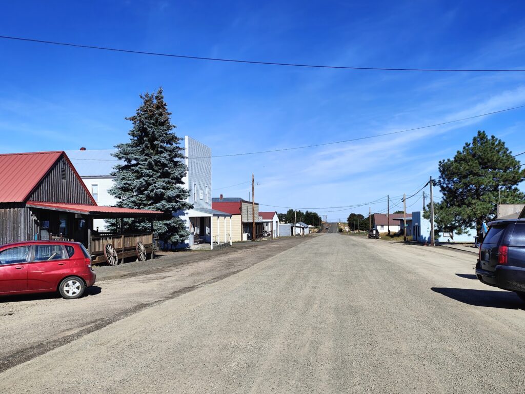
Bickleton
Fascinated by this time warp I had entered, I ordered a huge piece of blueberry pie and ice cream and a massive root beer and slowly came back to life. I was there for under half an hour; but it was time and money extremely well spent. Returning to the road, I spent the next two hours in an exhilarating ride along the completely empty highway, suddenly able to propel myself at speeds that an hour before had seemed impossible. After maybe fifteen miles, I suddenly crested a bluff and saw a whole new world unfold before my eyes. The fertile Yakima Valley lay beneath me. I could see for ever. In the far distance were more golden bluffs; but for many miles in between it was green. As I zoomed down many miles of wonderful descent, I passed between irrigated vineyards and frames of hops. When I could descend no further I arrived at Mabton, the first place since Bickleton and the first gas station for 62 miles, along with the first of many other modern conveniences. I popped into a small supermarket to find the ceiling completely covered with enormous, colourful piñatas. Where was I?
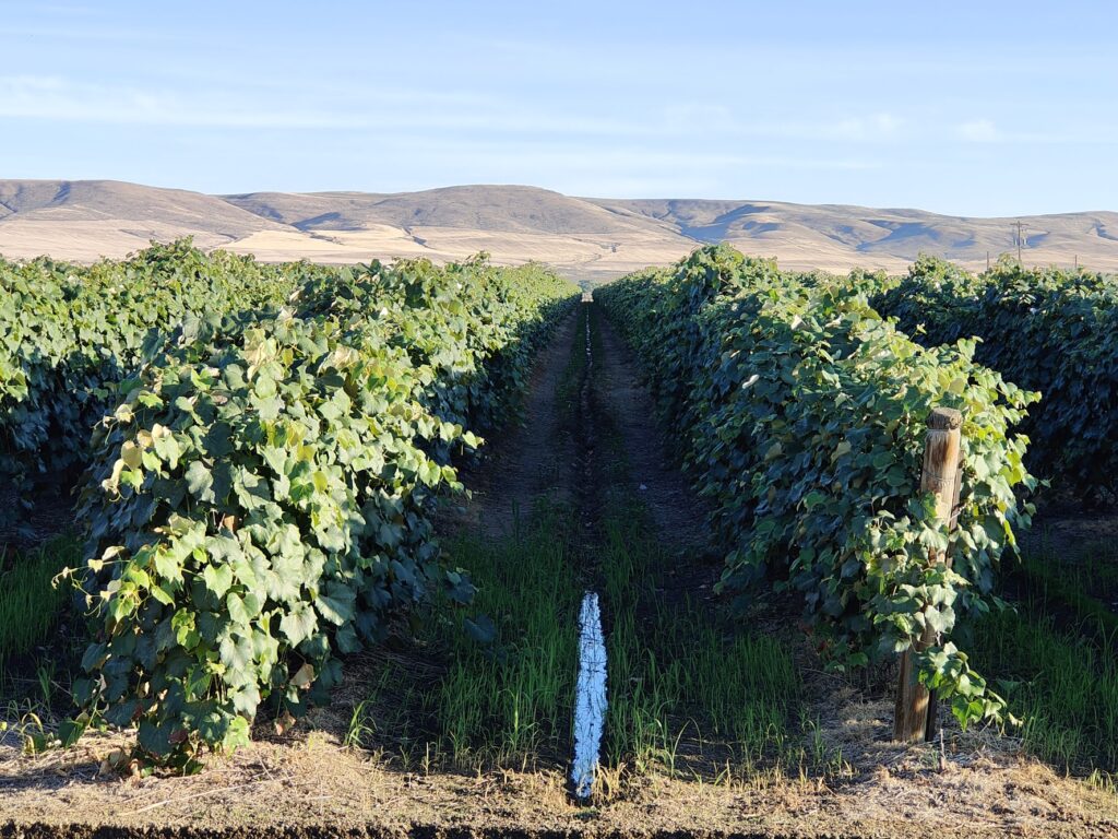
Yakima valley
The Yakima valley is an abundant area for agriculture and completely different in character from everywhere else I had been today. I saw many miles of apples, cherries, grapes, hops, asparagus, corn, wheat and dairy farming. There was a short detour to cross the Yakima River before I was riding parallel to another interstate highway and into the city of Sunnyside. It was true to its name today, and produced a lovely sunset as I found my motel and went out to find food and coffee among the endless roadside sprawl of businesses and malls.
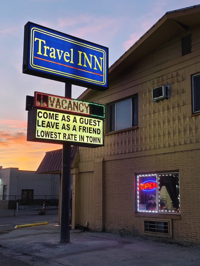
Home for tonight
And so another day came to a close in this much hotter, more humid part of Washington state. I will need the AC tonight and if I am wise I will be riding early tomorrow before the temperature gets up. Early starts are not a strength; but in the circumstances, it may be the only sensible choice. The forecast is saying it will get hotter still this week. I had better get used to it!
Kendal Mint Cake? Hope your travel insurance has unlimited dental coverage! Sounds a fabulous ride so far….
Was pleased to see that smuggled KMC kept you going! Got the picture with the Uncle Jesse reference!!
At my first look at the “Stonehenge” I thought of Spinal Tap😉
What an incredible day – love Stonehange and the loopy road looks amazing.