Day 6 – Beating the Heat


I’m in Idaho tonight! Only by about a mile, but it counts. Oregon and Washington are behind me and I feel a small sense of achievement. I should probably feel a big sense of achievement actually after the last 2 days. Each was over 100 miles of cycling and each was completed in extreme heat. Today, the temperature was showing 98F at noon, 100F at 4.30pm and down in Lewiston, where apparently it is always warmer, I saw a sign saying 112F just before 7pm. Either way, it was very hot.
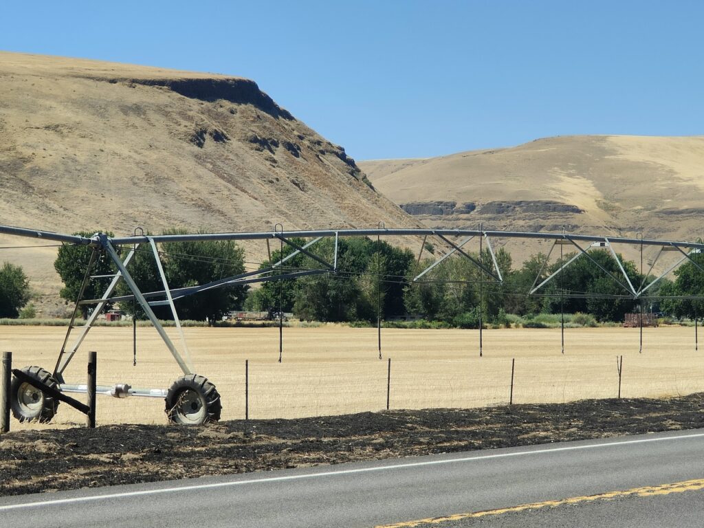
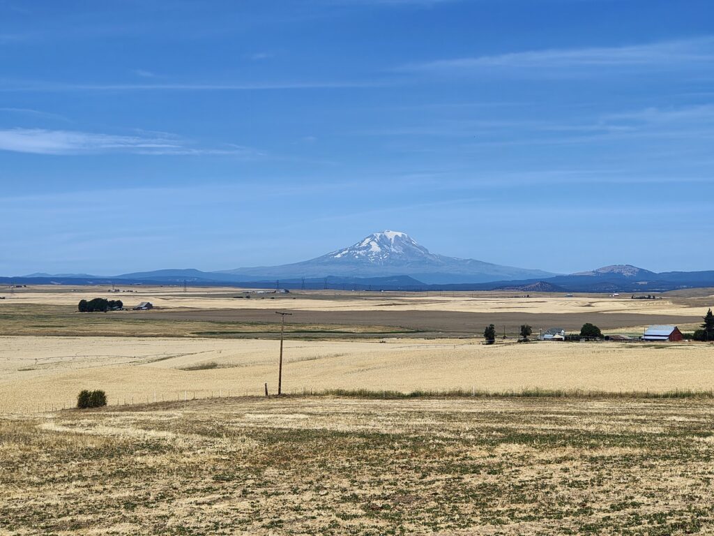
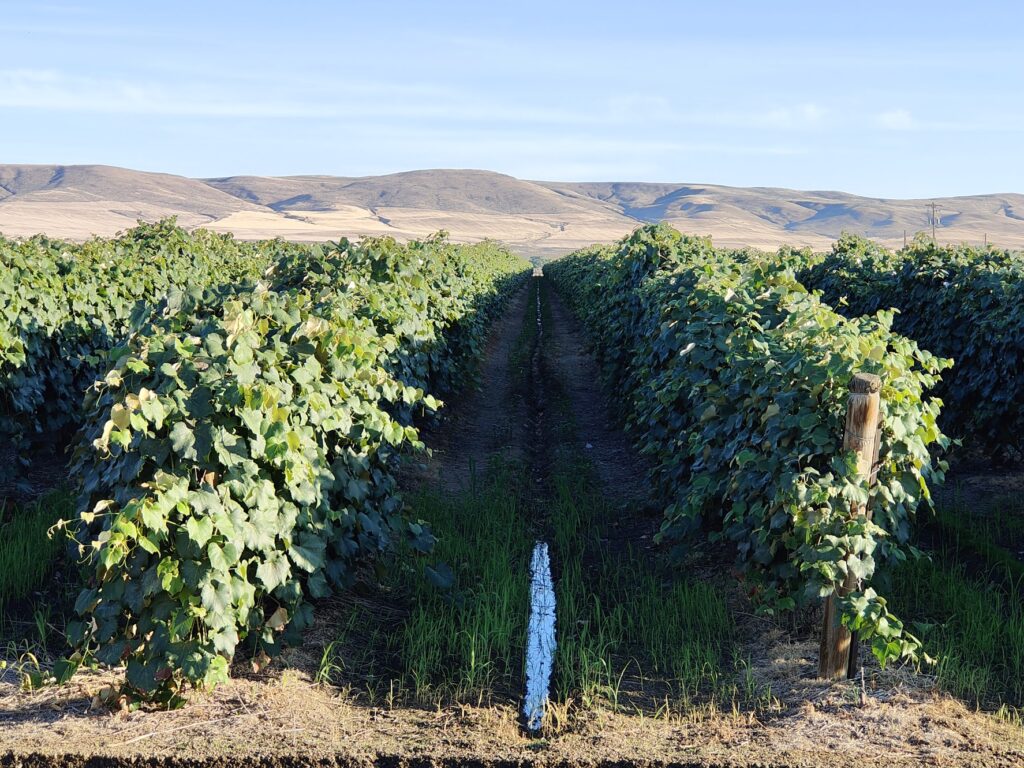
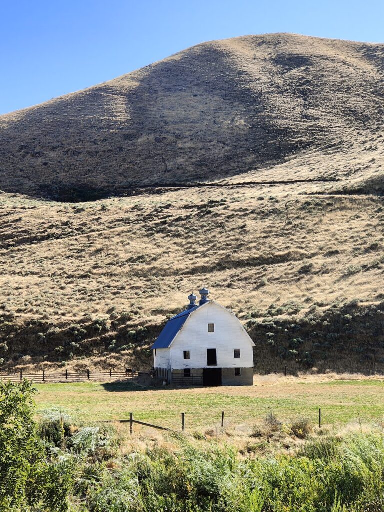
Palouse scenery

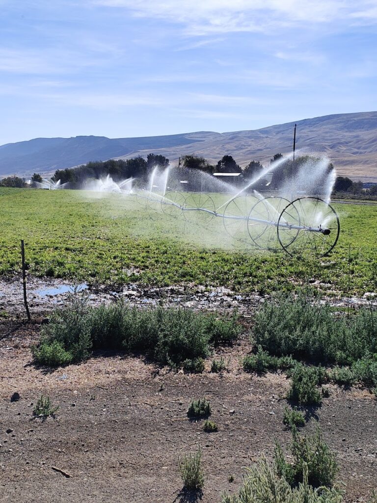
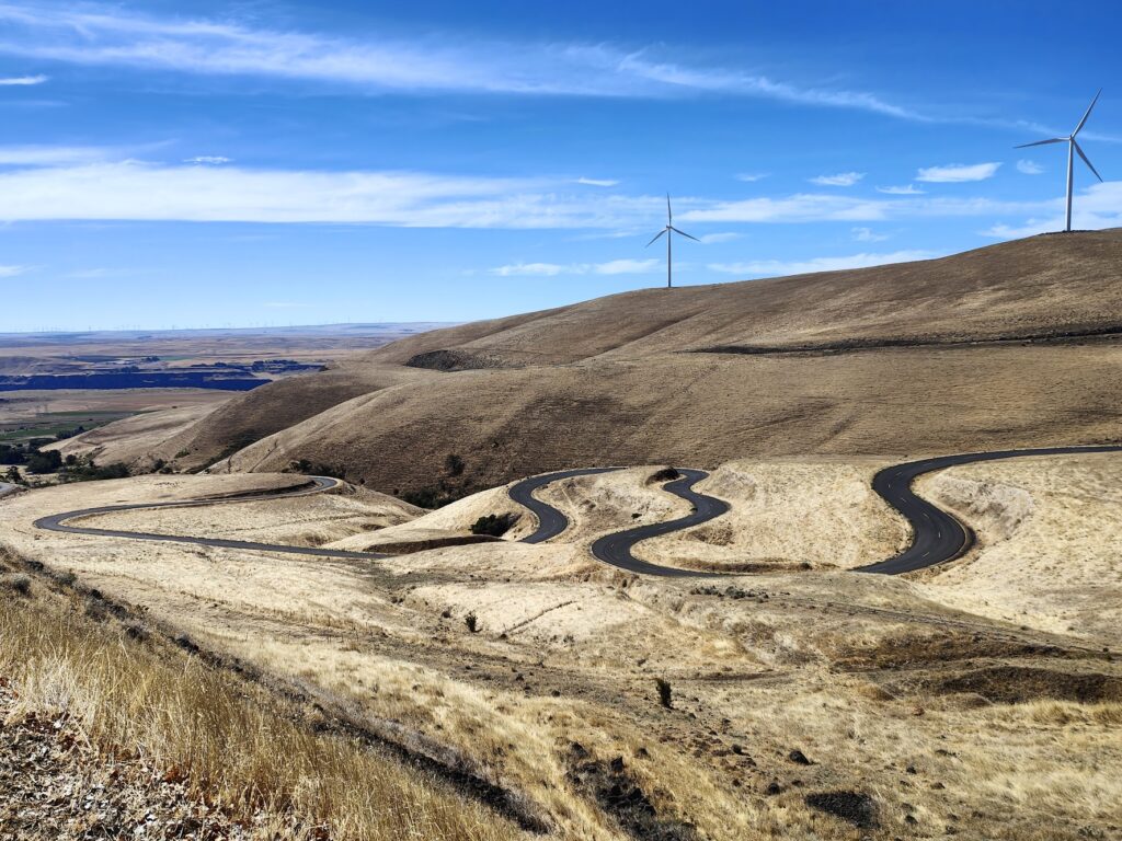
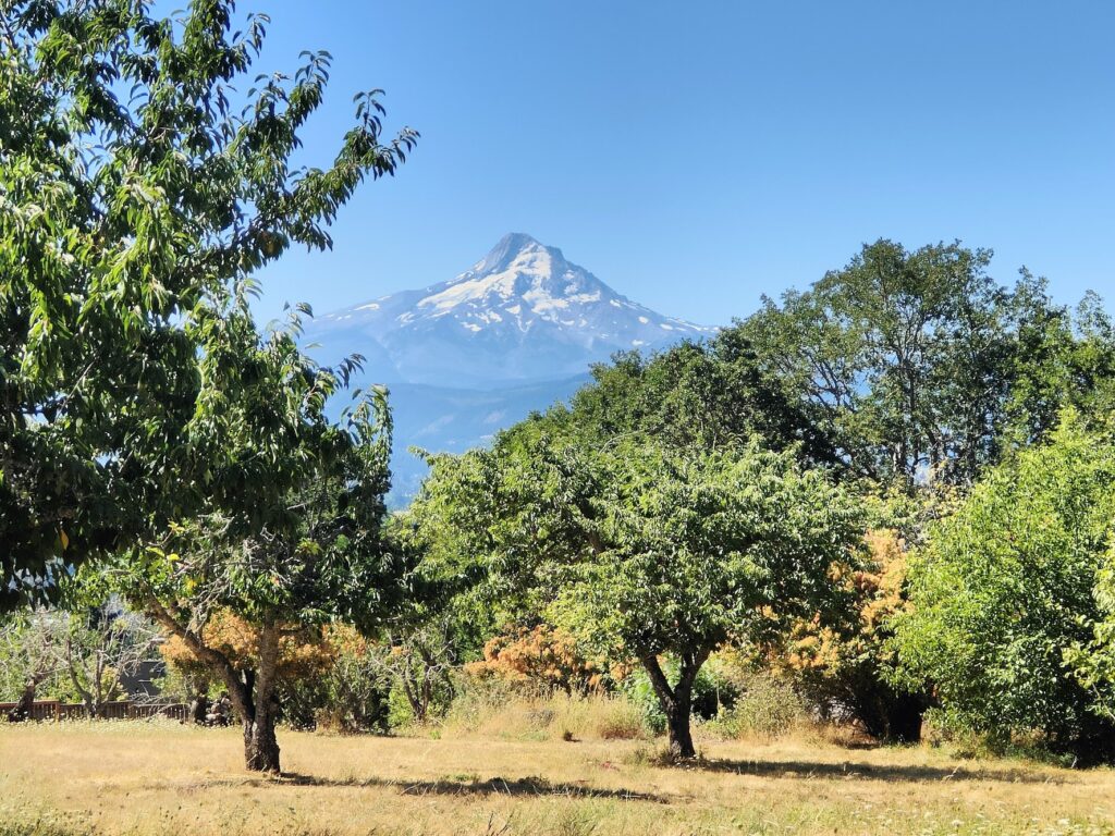
My ride today from Walla Walla passed through just 3 small towns: Waitsburg after 20 miles, Dayton after 30 miles, and then Pomeroy after 65 miles. Everything else was space in between, which largely consisted of straw coloured, hilly, rolling landscapes called The Palouse. This agricultural area is mostly known for wheat, of which I saw much evidence; but it also accounts for 30% of the world’s lentil production! Earlier in the year, according to photos on the internet, it is green; but it wasn’t today. Everything around me, including the stubble in the fields, the grasslands, even the earth, was the same light golden brown.
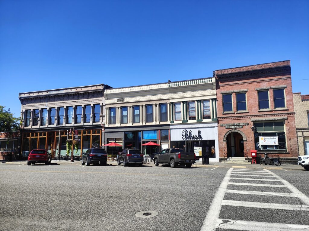
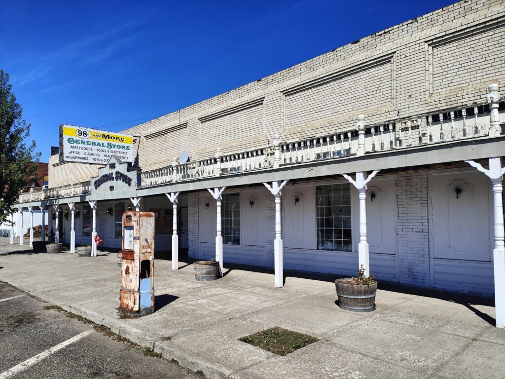
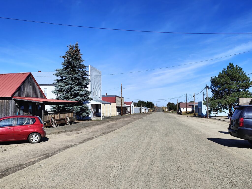
Waitsburg

I found a small store in Dixie, before I reached Waitsburg; but there was nothing in between the three small towns on my route: not a single gas station or roadside diner. Nothing at all. In the extreme heat, I had to be sure I had enough fluid to get me through up to 35 miles of pretty tough cycling. I stocked up on bottles in Dayton and made it through OK; but I went through plenty. After an hour or so all the ice had melted and everything was warm, but it was still water. You can’t risk running out.

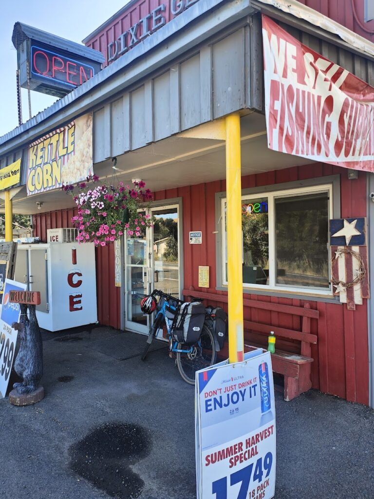
Never pass an open shop!

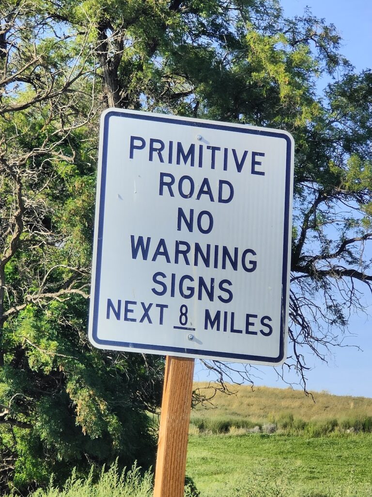
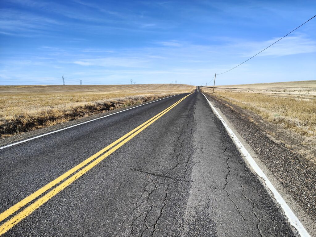
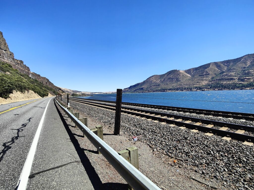
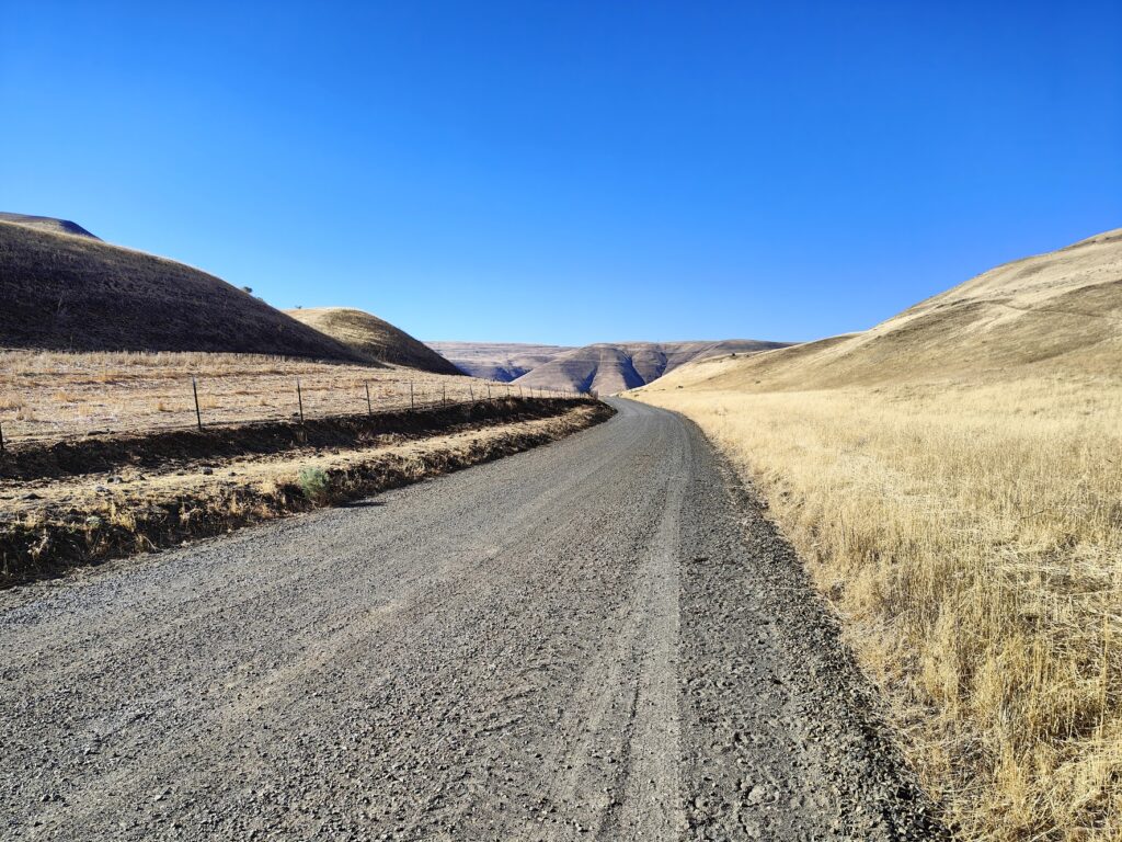
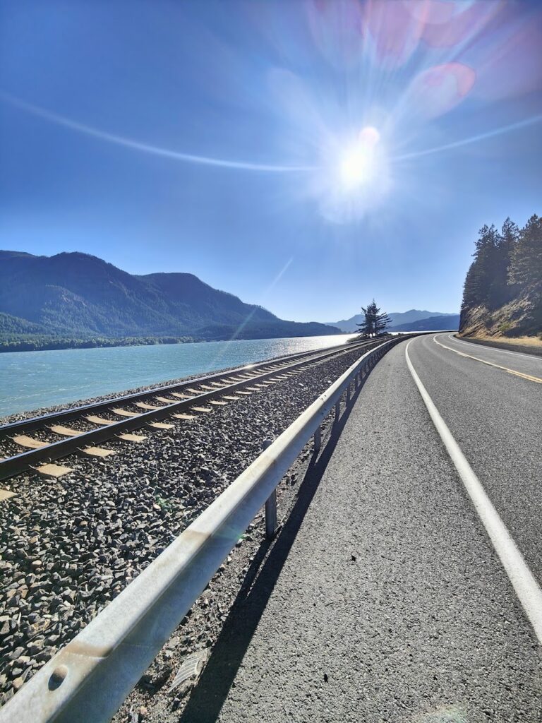
My entire route today was along US Route 12, which was a wide, well made highway that was fine to ride along its broad shoulder. There wasn’t very much traffic, although the traffic there was included many huge trucks travelling at speed, so you needed to concentrate. Most people give you a wide berth and it feels as safe and comfortable as most road cycling ever gets. I’ll be sticking to route 12 for a good few more days, and apparently it is a popular choice for people on rides across the country, like me. But I saw no one else on a bike today. And given the weather, that made a lot of sense.
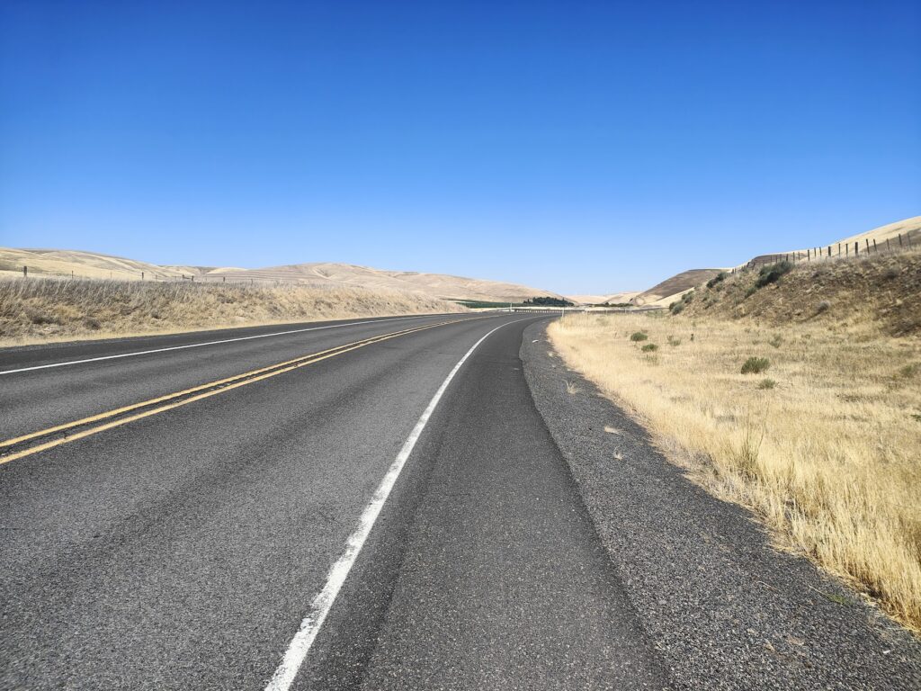
Big shoulders

To be honest, the heat hasn’t bothered me as much as I expected. It is reasonable until about lunchtime and then the oven really gets turned up until the sun sets. But the heat is dry and your sweat seems to evaporate regardless of how much you drink. The air is warm; but I haven’t found it too bad in general. You just get on with it.

Lunch in Dayton

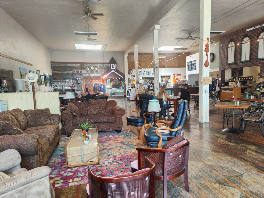
All three of the small towns today were quite pretty and offered refreshment in stylish cafes and shops. I wasn’t going to miss out on any of these opportunities to cool off and take on food and drink. In charming Waitsburg I enjoyed a large bowl of granola with fruit, yoghurt and honey, and some refreshing breakfast tea in an arty place with arty looking people. In Dayton, the biggest of the three, I had a very fancy salmon lox bagel for lunch in a huge, high ceilinged old emporium full of interesting artefacts. And in Pomeroy, which had vibrant hanging baskets everywhere, I had a wonderfully refreshing lemon smoothie in a lovely old fashioned hardware store that also sold ice cream. The people there were very friendly and we chatted about relatives in Birkenhead and took a selfie. Great fun.
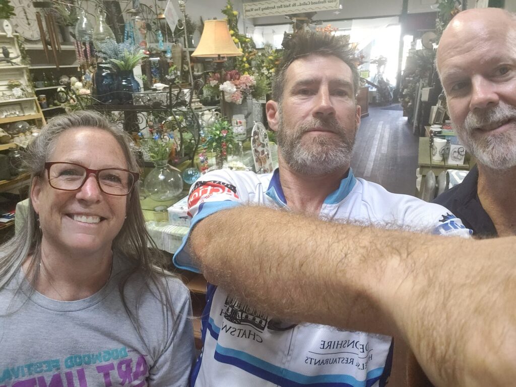
Pomeroy selfie

But the two best moments occurred a few miles either side of Pomeroy itself, and both were extremely uplifting to a flagging cyclist in 100 degrees of heat. The first was when I was still out in the wilds, thirty miles from my last rest. A car pulled over some distance in front of me in a lay-by and two people got out. One stood next to the road and held out a bottle of water like at a drinks station for a marathon. So I stopped. They said they had some idea how tough it was to cycle here in this heat and wanted to help. I was also handed a large apple. I still had some water left… but this was COLD! I drank it down at once and thanked them profusely. What wonderful people!

Full speed ahead

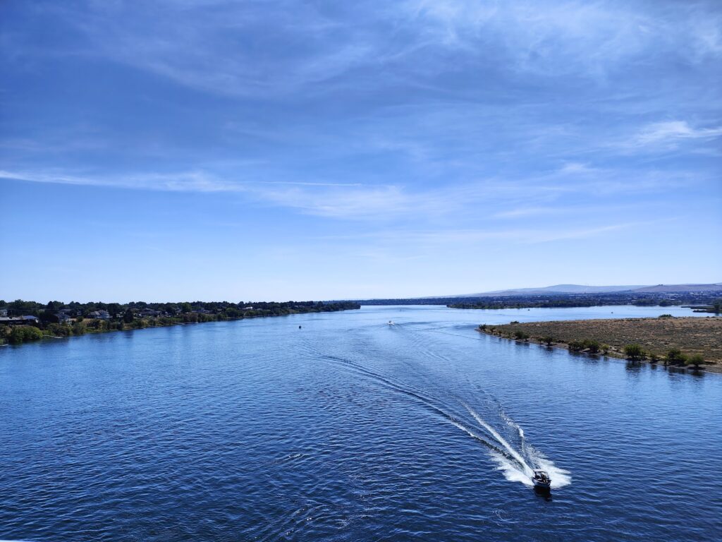
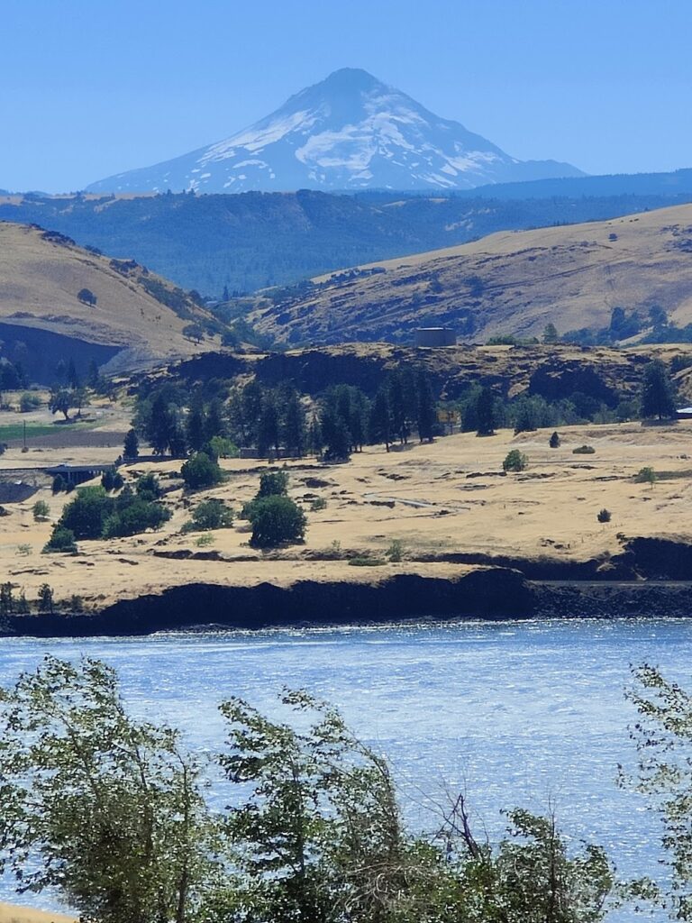
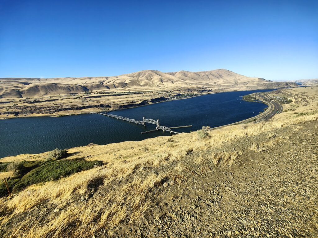
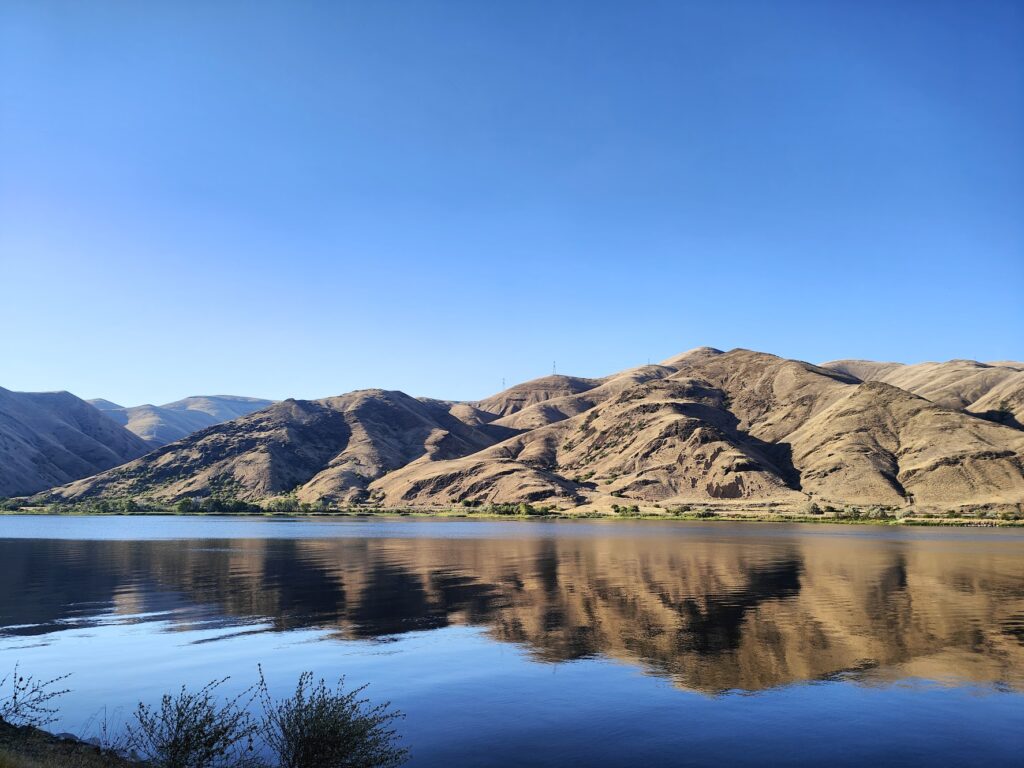
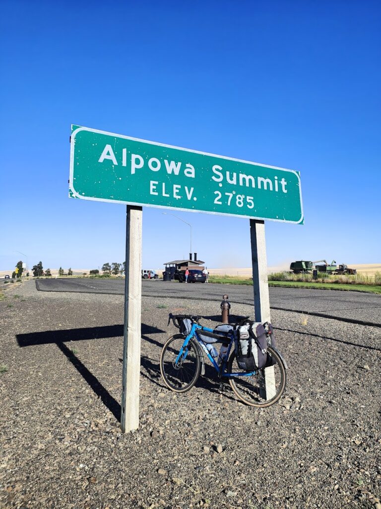
And then, perhaps eight miles beyond Pomeroy, when I was still feeling reasonably strong, I reached the top of a long, gradual climb to be faced with a high, broad plateau where a combine harvester was working. There was a rest stop for vehicles and a big sign for trucks to test their brakes. I soon found out why. For the next ten miles or so, the road plunged downhill. I freewheeled the first five miles or so before it got less steep. I forgot all about the heat and the hard day I had endured so far. This was epic! The descent was far longer than the climb and took me from Alpowa summit at 2,785 feet of altitude down to something like 700 feet, at which point the road dramatically joined the banks of the vast Snake River, now hemmed in on both sides by large brown mountains and looking a very different proposition to what I had seen yesterday. A few green trees and shrubs lined the banks and then it was desert like either side. I was reminded of the Nile. Except for the paddle steamer that went past as I watched.
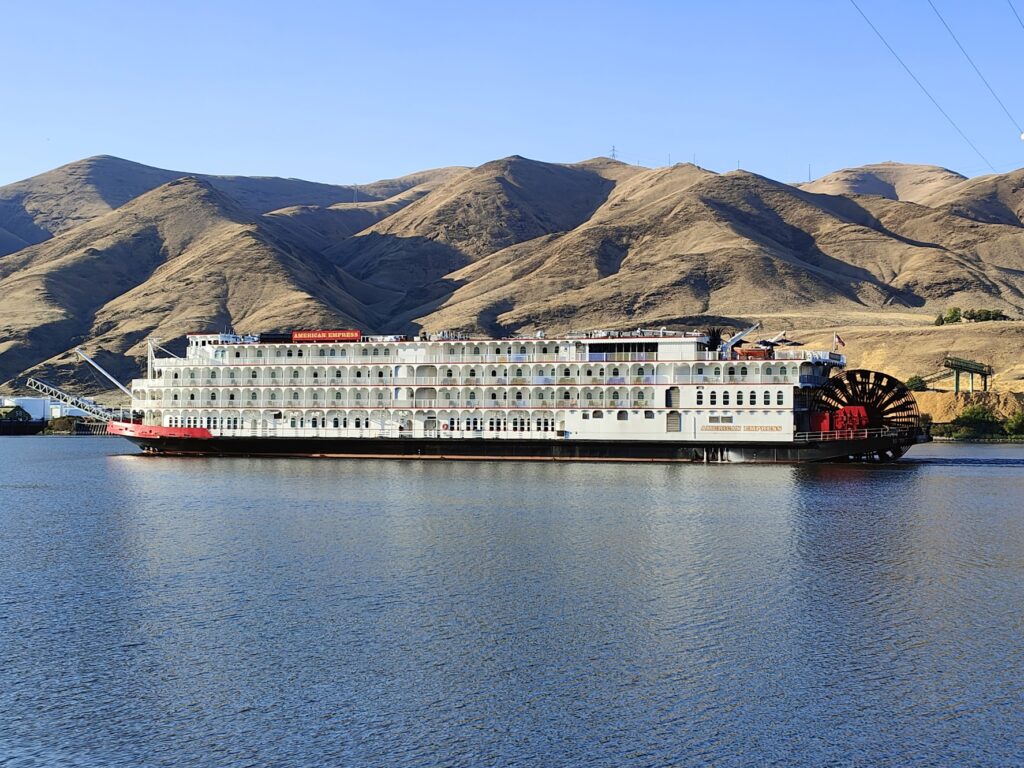
Snake river steamer

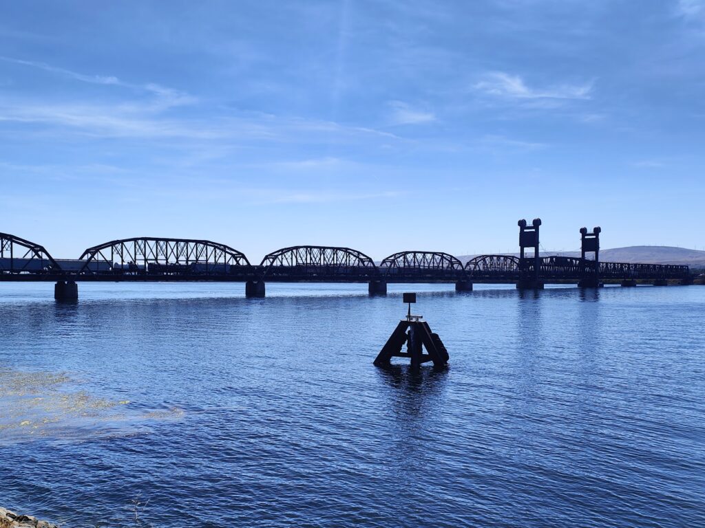
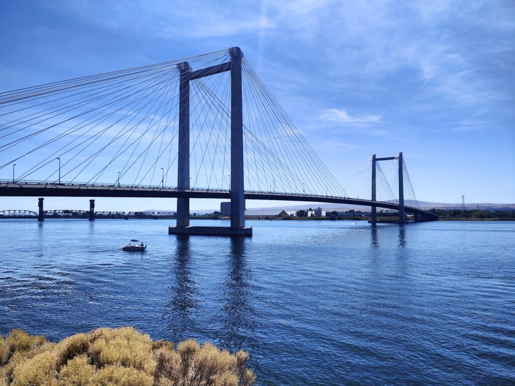
A few miles later I was in Clarkston, and then over a bridge over the Snake River into its twin, Lewiston, which is my introduction to Idaho! Yet another big river, the Clearwater, joins the Snake here, and that is what I will be following tomorrow. That requires an outrageously early start and breakfast is served from 5.30am! Time for bed.

Day 5 – Gravel and Warm Showers

It got better

I had more than 100 miles to cover today, so an early start was necessary and – for once- achieved. In the relatively cool morning temperatures I made excellent initial progress, skimming along through the irrigated agricultural surroundings of the Yakima Valley on mostly empty roads between fields of grapes or apples or hops. Around 10am I stopped in the small town of Benton City at a charming little coffee shop for some welcome breakfast. It was run by two of the loveliest young people I have met in ages – a couple perhaps- and it seemed to be newly opened. I was the only customer and I stayed for a while. I hope they make it.

How they keep it green

Pushing on, I reached the edge of the Tri-cities of Richland / Kennewick / Pasco, which sit on the banks of several rivers that come together here. Easily the largest is our old friend the Columbia River, still very broad at this point where it performs a kind of shepherd’s crook turn back to the northwest. I crossed it for the fourth and last time on this trip and moved from Richland into Pasco. Google maps was doing well so far today and it took me along a magnificent series of bike paths that stuck close to the Columbia River bank. People were out in speedboats enjoying the relative cool the river offered, speeding under the huge bridges. The rest of the town looked uninspiring but I would happily have stopped for a drink or even a meal at a riverside cafe had there been one. Yet among lots of public parks and cycle paths, nothing at all was to be found. It was bring your own picnic or nothing. Not even an ice cream seller, who would have made a killing in this heat.

Beating the heat

My main excitement, beyond the river and its boats and bridges, was the sight of a slow-moving freight train crossing the rail bridge. Despite the river’s great width, the train was about twice as long as the bridge!

Train bridge

I finally crossed the not insubstantial Snake River. This major waterway starts its life up near Yellowstone and winds its way through many spectacular parts of the western US to empty into the Columbia at this rather drab point. On the far side I finally found a Subway clone at a gas station in a new-build housing development. Any port in a storm.

Every time I stopped I would drink seemingly gallons of fluid – especially my favourite Root Beer – but in this heat I was still facing an uphill battle to stay hydrated. I would drain my water bottles of warm water between stops and then refill them with ice and cold water. A sign hours later at 6.38pm put the temperature at 92 F /34 C. I was out cycling before in the worst of it. I don’t remember needing to pee all day.

Big river

That was partly why I cursed Google maps after all its good early work, for taking me back onto gravel. My route to Walla Walla, where I am staying the night, was about 40 more miles and I was offered two suggested routes. After a further root beer stop at the road junction decision point, I opted for the one that said “Best route” rather than the one that said “Less traffic”. My route set off arrow straight along a good quality road that serviced various large agricultural concerns. It was completely traffic free. Then after perhaps ten miles, it suddenly turned to gravel. I was alone in the middle of absolutely nowhere once again in the searing heat; but I knew I had almost reached a T-junction, so I continued. It was hard going and slow. When I reached the junction after a couple more miles, the new road was also gravel, only with bigger hills. It also announced itself as a primitive road. You don’t say. This was really not fun. In the end I had about an hour of it and although it got better, I had a scare or two. After that, and one final root beer to calm and cool me back down, I ignored Google maps and stuck to the excellent and very quiet old route 12, which I have been advised to stay on all day tomorrow as well.

I got to Walla Walla on time to meet Brad, my first Warm Showers host. This is an excellent internet community I have just joined, where long distance cyclists offer each other a bed for the night. And it seems to work! So I didn’t want to arrive late, because Brad wanted to go out for beer and food. Which we did, as soon as I had my warm shower. I suspect I will be using this again, although the membership pays for itself the very first time! What a clever idea. Brad is a tri-athlete enjoying his retirement years by staying very fit. He advised me not to work a day longer than I have to. I couldn’t agree more.

Day 4 – The Bickleton Highway


Today was a day of several different parts that were all, in their own way, very memorable. I began, a little later than I had hoped, by crossing the Columbia River back into Washington and climbing up from the riverside village of Maryhill to Stonehenge. Well, a full size replica of Stonehenge at any rate. It stands up on a high bluff overlooking the river and was erected as the nation’s first WW1 memorial, in honour of the servicemen of Klickitat County who died in service. It is built from reinforced concrete after the local stone proved unsatisfactory. The position of the altar stone was fixed during a total eclipse of the sun in June 1918. This was about as bizarre a start to my day as I could have imagined; but it made for some great final views of the gorge before I climbed up higher to the northeast.


Google maps played more tricks on me today; but I have forgiven it because they brought about some amazing experiences. After Stonehenge, it told me to take Maryhill Loops Road up to the very top of the river valley bluff, a good stiff climb of 850 feet. The signs by the turning said it was a dead end; but Google maps said otherwise. It looked interesting and was accessible through a narrow pedestrian gate, so I gave it a go. This “historic road” was once the only link between the Columbia River and the town of Goldendale, WA to the north. The lower stretches of the road are well preserved and I had it completely to myself as I climbed through 25 curves, 8 of which are hairpins. It loopeth muchly, keeping the gradient to under 5%. But then it stops. The road reached a viewpoint, by a spring with a drinking trough and a bench, and that was it. Almost. It carried on quite a lot further in much rougher condition before reaching a locked set of gates. Since there were signs on the other side of these gates telling people from above not to enter, I surmised I would be fine once I got over, which required nothing more than removing my panniers and lifting them and my bike above the obstruction. As it happened, this manoeuvre had to be repeated near the top; but I made it and had to give Google maps a little credit, even if it wasn’t strictly the right thing to do.

Loopy

Joining in with the main US 97 highway, I climbed over the final hump to be presented with a stunning view of Mount Adams in front of me across the golden plains. A nearby viewpoint said this majestic snow-capped volcano, not unlike Mount Hood in appearance, was 45 miles away. Mount Hood, also visible, was now 50 miles behind me. You could even just make out the white summit of Mount Rainier, 85 miles away, such was the vastness of the landscape and blueness of the sky.

Mount Adams

I cycled on into Goldendale, a small town known for its dark, starry skies and observatories. The town itself was very sleepy but offered my final chance of sustenance for hours to come. Wisely, I stopped and enjoyed an enormous breakfast burrito. How glad I would be of that in 30 more miles.


The Main Street headed east and became the Bickleton Highway. A sign warned that there was “no gas for 62 miles”. Not even in the only settlement I was expecting, Bickleton, 35 miles distant, which worried me. The first 20 miles or so was pretty decent cycling through golden grasslands along straight, empty roads. But it was hot and I needed to make sure my 2 litres of water got me to Bickleton at least. My spirits flagged when, after 25 miles, I suddenly found the highway turning to gravel. That was not what I needed. It lasted for 2 miles, after which I found a very rare patch of shade and broke out some Kendal Mint Cake. It took another such stop five miles later; but it did the trick and I rediscovered the will to live. Seven miles later, the first houses began to appear and then Bickleton’s very modest Main Street arrived, just as the gravel briefly started again. It wasn’t much of a place after 3 hours of hot cycling (there was a sign saying it was 87 degrees); but it had an old, wooden general store and cafe and I stopped.

Bickleton Highway

Inside I entered a different world. The large room had shelves of provisions around the side walls and tables and chairs in the space in between. Mostly it had one single, large table at which several of Bickleton’s ageing residents were gathered. They looked up and acknowledged me then got on with their card game. Most of the men wore dungarees and baseball caps, reminiscent of Uncle Jesse in the Dukes of Hazard. One waved a fly swatter absent-mindedly, although there were no flies.

Bickleton

Fascinated by this time warp I had entered, I ordered a huge piece of blueberry pie and ice cream and a massive root beer and slowly came back to life. I was there for under half an hour; but it was time and money extremely well spent. Returning to the road, I spent the next two hours in an exhilarating ride along the completely empty highway, suddenly able to propel myself at speeds that an hour before had seemed impossible. After maybe fifteen miles, I suddenly crested a bluff and saw a whole new world unfold before my eyes. The fertile Yakima Valley lay beneath me. I could see for ever. In the far distance were more golden bluffs; but for many miles in between it was green. As I zoomed down many miles of wonderful descent, I passed between irrigated vineyards and frames of hops. When I could descend no further I arrived at Mabton, the first place since Bickleton and the first gas station for 62 miles, along with the first of many other modern conveniences. I popped into a small supermarket to find the ceiling completely covered with enormous, colourful piñatas. Where was I?

Yakima valley

The Yakima valley is an abundant area for agriculture and completely different in character from everywhere else I had been today. I saw many miles of apples, cherries, grapes, hops, asparagus, corn, wheat and dairy farming. There was a short detour to cross the Yakima River before I was riding parallel to another interstate highway and into the city of Sunnyside. It was true to its name today, and produced a lovely sunset as I found my motel and went out to find food and coffee among the endless roadside sprawl of businesses and malls.

Home for tonight

And so another day came to a close in this much hotter, more humid part of Washington state. I will need the AC tonight and if I am wise I will be riding early tomorrow before the temperature gets up. Early starts are not a strength; but in the circumstances, it may be the only sensible choice. The forecast is saying it will get hotter still this week. I had better get used to it!

Day 3 – Green to Golden Brown

Mount Hood from my BnB in White Salmon, WA

Today was a shortish day due to the apparent unavailability of accommodation where I really wanted it further east. The fact is, it’s a desert out there. So I settled for a short day today and a long one tomorrow. But it was still long enough to fill an afternoon with great cycling through more epic scenery.

Today the world slowly changed from mostly green and forested bluffs to almost completely treeless hills covered with golden brown, dry grass. The east side of the Cascades range has a very different climate. I was told that for every mile you travel east of Cascade Locks, you lose an inch in annual rainfall. Even if that is not literally true, since I am now about 75 miles further up the Columbia River gorge, it should come as no surprise that everywhere here looks dry and arid.


I allowed myself a lazy start to the day, enjoying the lovely, lofty surroundings of White Salmon, a small town I think I could happily live in. It seems to have just about everything you could want on its doorstep for every season. It is home to healthy looking, outdoor loving people, many of whom seemed to have congregated at the superb bakery, where you could watch bread being kneaded and baked before your eyes. I phoned home in between two separate, equally delicious brunch sittings, with excellent tea, and reluctantly tore myself away when I felt I had probably overstayed my welcome.


For the first hour I shared a table with Stephen, a retired native of Boulder, Colorado (which is a sister city of Hood River, Oregon, just over the water). Stephen was well travelled and knew plenty about the world. He was recently at his son’s wedding in a Scottish castle that must have been close to Dull! We chatted amicably about different places and he told me he was just recovering from an infected leg that had required an operation and 30 days in hospital. He was going to a local Buddhist monastery to rehabilitate in peace. Luckily he had good medical insurance and – partly due to a hospital administration error – all of the cost of his treatment had been covered. His 30 day bill was an eye-watering 187,000 US dollars. It is no wonder that inability to pay medical bills is the single biggest reason people lose their homes in this country, and why having a job with good “benefits” is so important to everyone here. It made me more grateful than ever for our National Health Service, without which I could not so easily be living this privileged, adventurous life. Never take it for granted!

Mount Hood and the Columbia River


Descending swiftly to the banks of the Columbia River, I resumed my journey easy alongside the freight trains and the wind surfers. It was a bright, breezy day, and the wind was in my favour. It created waves and white horses on the broad river and a lot of people were out enjoying the conditions. The cycling was good and I made swift progress to the next bridge, 20 miles upriver at The Dalles (“Dals”), where I crossed another Meccano bridge to re-enter Oregon. I thought, correctly, this might be my last chance for refreshment, so I pulled into Big Jim’s Burgers, principally because the large sign declared them to be made “with love”. It was a good move. This establishment was close to the Interstate Highway, and it’s clientele were, in general, not at all like those I had seen earlier in White Salmon. This was a different America; but nevertheless one that serves excellent burgers and fries with a smile.

Big Jim’s in The Dalles

Now in Oregon, Google maps sent me on a promising route that wound its way gently through dry, grassy hills up a small valley just out of sight of the Columbia River. It was traffic free and for several miles I celebrated my good fortune. It felt like I was finally in the middle of nowhere, USA, on an excellent road surface and all alone. I was happy.

The middle of nowhere

Then it got interesting. Google maps wanted to send me up a hilly, unsurfaced road next to an old wooden school building. I double-checked: there was no doubt about it. It looked pretty dicey. But there wasn’t another viable way I could take. Which explained why the road I had been following was so quiet: it went nowhere!


Navigation is an issue for the trans-continental adventure cyclist. The paper maps here just don’t go to the level of detail I would like. I didn’t want to retrace my steps all those extra miles. So I gave it a go. The gravel ran for several miles. I saw few cars. I actually saw some tumbleweed blow past me. The road crested the hill and provided spectacular views of the Columbia River above a train bridge, and I could see my destination away in the distance. I rode gingerly with my loaded panniers, mindful of the possible consequences of over-confidence, especially on the steep downhill sections. On a mountain bike it would have been fun. But not in my situation. And then, just like that, I was back on the smoothest, straightest and emptiest of wide tarmac highways, all the way to Biggs Junction, Oregon. Thanks Google maps.

View from my gravel road

Biggs Junction is an odd place. It is where one of the few road bridges crosses the Columbia River, intersecting with the Interstate highway on the south bank. It is more a collection of gas stations, motels and fast food restaurants than a settlement. But, tonight, it is home to me and my bike. My motel is so close to McDonalds that I am using their free Wi-Fi. But this place is something of a relic of a bygone era, now surrounded by huge truck stops and enormous neon signs. I hope it hangs on amidst all this ugly modernity.


Yet despite all the traffic noise and surrounding oddness, from my window I am treated to the most spectacular of view west along the Columbia River, with Mount Hood still dominating the horizon. I will leave it behind tomorrow. And I’ll miss it.

Day 2 – The Columbia River Gorge


Some days are just exceptional from start to finish. Today was one of those. And not just the weather, which has been simply amazing now for two straight months. That has become almost an expectation. Today served up much more.
It began with a healthy breakfast that included proper leaf tea in a teapot, at the amazing McMenamin’s Edgefield Hotel, an old Poor Farm given a new lease of life (Google it). Here, the night before, I had enjoyed an amazing outdoor salt water hot spa pool. The whole place is a work of art and oozes character and personality.


But cycling had to occur at some point. I managed to get away while it was still morning and almost immediately set out along the fabulous Historic Columbia River Highway. Built by the 1920s, this was the first “good road” along the vast Columbia River valley, which separates the states of Washington and Oregon in the most dramatic fashion. The Columbia River flows down from the Canadian Rockies; but this lower east-west flowing section is a huge body of water, probably half a mile or more wide and well over a hundred miles long. It runs west from the arid, desert-like eastern portion of the Pacific Northwest, through the Cascade mountains, to reach the Pacific Ocean a little north of Portland. It is a breathtaking, bright blue sight and I felt this gorge would be a good way to start the journey east. And so it proved.


The old scenic highway was almost traffic-free and a delight to ride. It took me to over 600 feet above the river, where there were a couple of scenic lookouts. Then it plunged down hairpin bends to the water level, where it stayed close to the railway and the newer Interstate highway. Hereafter, in just a few miles, I must have passed at least half a dozen spectacular waterfalls on the south side of the river valley. Any one of these would be famous in Britain. Perhaps the biggest and best was Multonomah Falls; but honestly they were all top class.


Stopping so often slowed me down, of course, but this was superb country not to be missed. I rolled into Cascade Locks, where I had started out on the Pacific Crest Trail on 25th June this year, around 4pm. Just in time for lunch, then, at the local microbrewery. The beer situation in the USA is unrecognisable from the country I first knew 38 years ago. Today you can get excellent, locally made beer pretty much everywhere, it seems. I look forward to putting that to a stern test. So far, however, so very good!


Refreshed and recharged, it was time to ride across the Meccano-like Bridge of the Gods to the north side of the Columbia River, and the state of Washington. The bridge spans a narrow part of the gorge where there was a landslip around 500 years ago. The name comes from Native American stories of a natural crossing point; but over time the force of the river turned this landfall into roaring whitewater cascades, later tamed for shipping by the building of locks (hence the name of the small town). From here, after cycling nervously over the metal grill road surface of the bridge, I was able to follow the flat north shore, also alongside a railway, until I was level with my journey’s end today at White Salmon, 30 miles away. There were no bridges in between. This is a serious waterway.


There were, however, freight trains that seem to run with great regularity along both banks of the river. In the USA these are seriously long. I rode alongside a stationary train, waiting for a signal, and counted 2 engines pulling 65 flatbed wagons, each with 2 shipping containers. That is a lot of train! They rumble slowly along; but cover huge distances, running through day and night. They take priority over the few passenger trains here. They have the most evocative, wailing horns and I find them a fascinating part of the nation’s transport infrastructure. You can’t possibly capture the almost endless length of a freight train in a photo, although from across the water I did get some idea of how far they stretch.

Spot the train on the other side


My other entertainment in the last couple of scenic hours of cycling was a section of several short tunnels. Cyclists were instructed to stop and push a button by the roadside before moving through each tunnel. The button activated a flashing road sign to alert motorists. The tunnels were wide enough for two vehicles to pass; but not overtake me as well. I was glad of the extra precaution.


But overall, again, the riding was a pleasure. The roads were good, the traffic not too busy and there was generally plenty of space at the side of the road for me to stay out of everyone’s way. Long may that continue.

My destination this evening, White Salmon, is a delightful spot. It looks south across the river gorge from high up on a bluff to the larger town of Hood River on the south bank. Rising imperiously above to the south is the epic sight of Mount Hood, all 11,250 feet of it, complete with glaciers, dwarfing everything else around. When I arrived in town I was greeted by another cyclist, Wesley, who looked much younger and fitter than me. He came out to meet me later for a beer and I learned that he almost became a professional racing cyclist. He certainly looked the part. He’s just moved out here from Seattle and I have to say it feels like an amazing place to live if you like the outdoors. I could imagine bringing up a family here like Wesley will soon be doing. There is a lot to like!


And so ends a great day. I will awake to morning views of Mount Hood and then make my way gingerly to the bakery in the small but attractive town centre, because it’s there and I can. And then I’ll do a bit more cycling through this enchanting part of the world. In the sun.