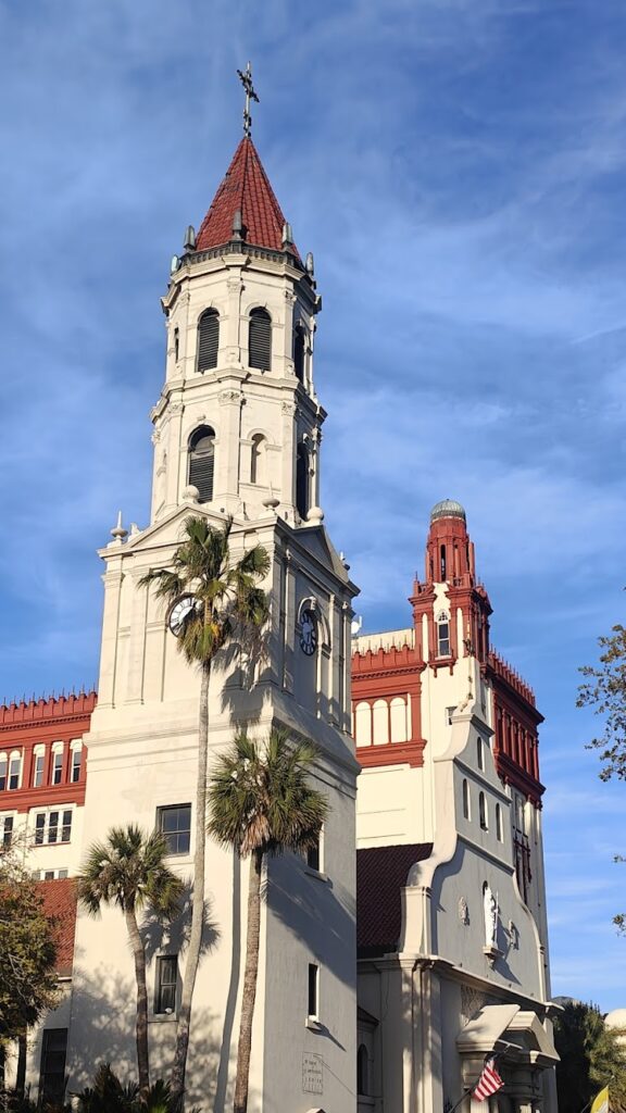
Saint Augustine is the oldest continuously occupied European settled city in the USA. And it is very proud of it! It was founded in 1565 and was also the site of the first Catholic Mass. The city was founded 55 years before the Pilgrim Fathers arrived in New England, and was under Spanish or British rule for longer than it has been a part of the USA. It also contains the oldest masonry building in the continental US, Fort Marcos, which has guarded the city for centuries and withstood every attack.
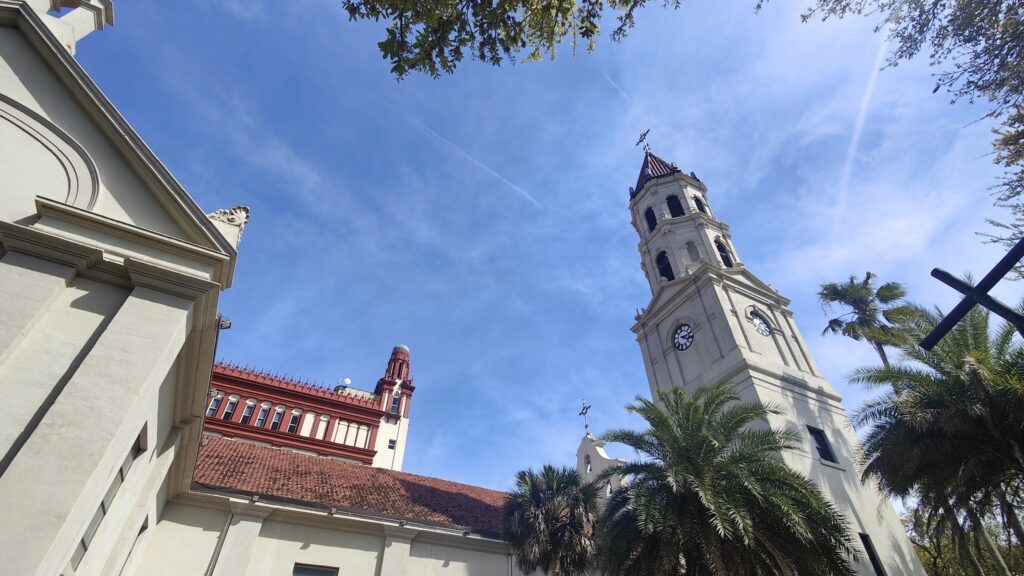
Cathedral of St Augustine
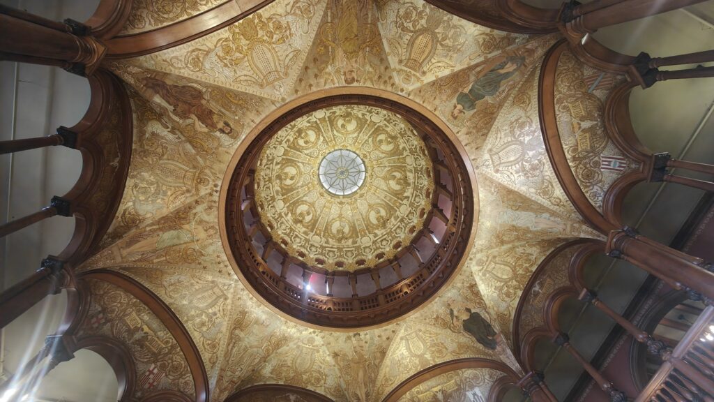
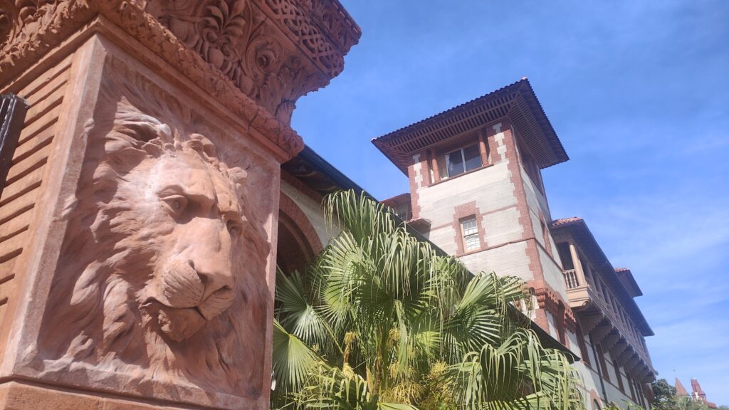
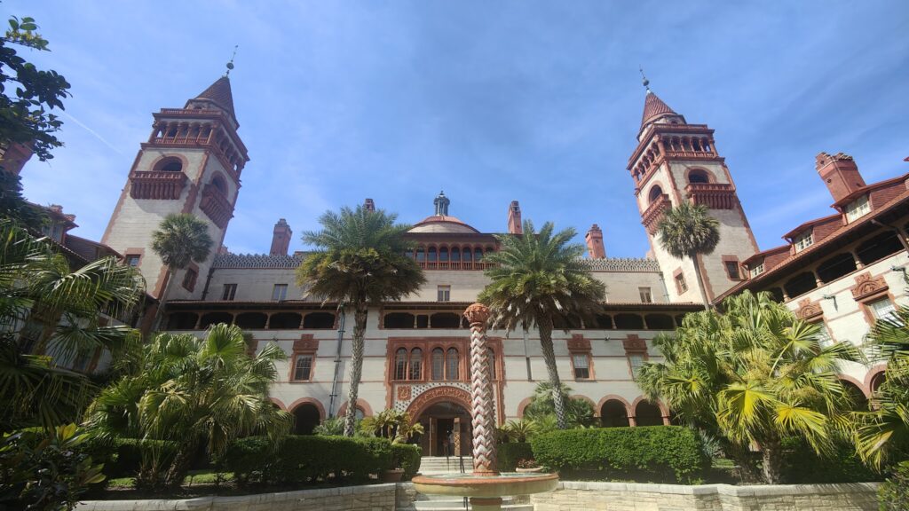
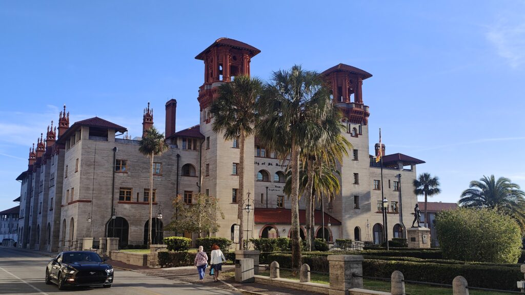
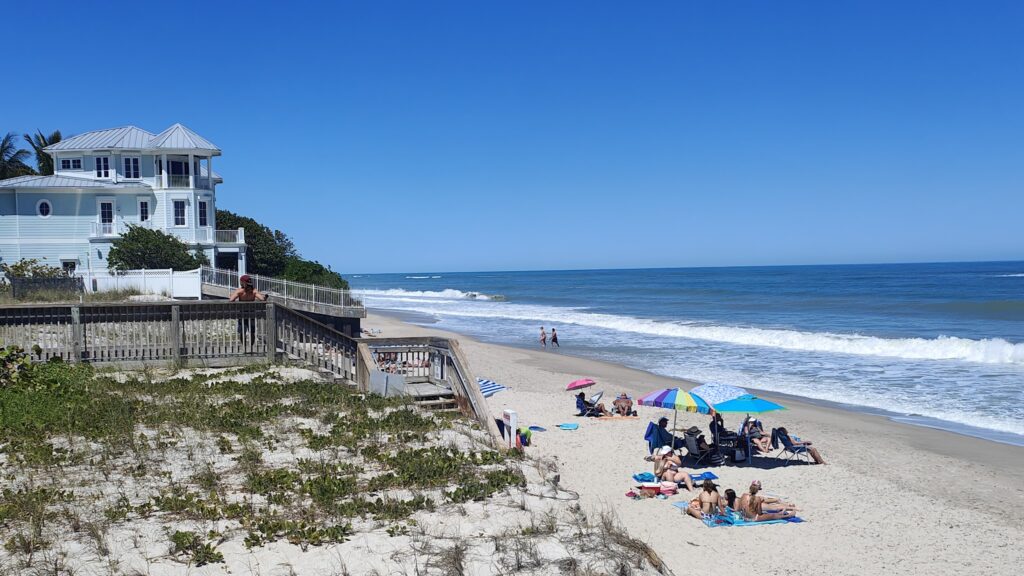
But there is much more to see here, and a lot of the most interesting buildings date from the late 19th century, when it was developed by Henry Flagler, a business associate of John D Rockefeller, to create a southern riviera destination accessible by railroad. His idea was a great success and there are several buildings that grace the small city centre that were for many years among the most splendid hotels of their age. They are now college buildings and the City Hall, but once played host to the rich and famous, providing the most opulent surroundings. The most flamboyant was the Hotel Ponce de Leon, which is an architectural extravaganza, with towers, a dome, courtyards and the largest private collection of Tiffany glass in the world. Tiffany himself was the interior designer. The students for whom this is now home are lucky indeed.
Former Hotel Ponce de Leon
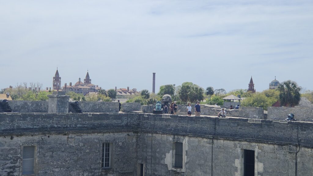
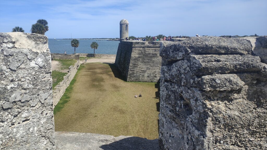
I walked around Fort San Marcos with the hoards and enjoyed the views of the river and the access to the sea that it protected. The Spanish had all angles covered with canon crossfire. Apparently there is also something special about the soft stone from which it is built that allowed it to withstand bombardment in times of siege.
Fort San Marcos
Before Florida was ceded to the United States, this city was exchanged in various wars and treaties between the Spanish and the British, and the complete history is a complicated affair. There was much coming and going of people, including pirates, slaves, native Americans, missionaries and invading forces. Black people have lived here for centuries, both free and enslaved in parallel, and slavery continued to be practiced here until 1862 after the American Civil War. Today there was a great deal of Spanish being spoken in the streets and every information sign and leaflet was in both English and Spanish.
Opulence
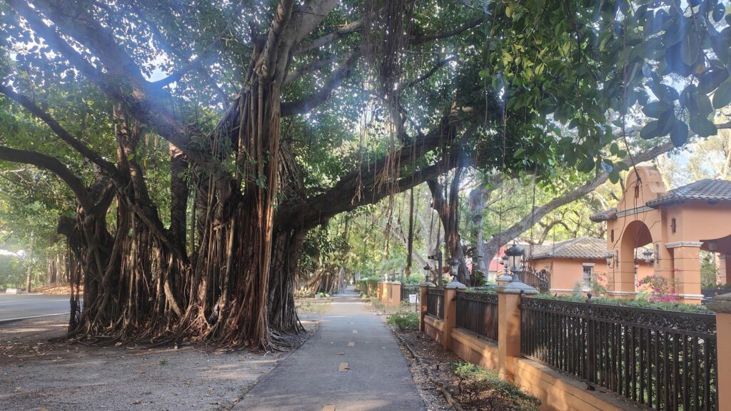
Overall it is a likeable place on a human scale: easily walkable with many car free streets and fine buildings. It has a lovely riverside setting with a large, many arched bridge that opens for boats to pass through, and several fine churches. The streets are also lined with live oaks, big native trees which live hundreds of years and are coated in long, wispy cobweb like strands of Spanish moss.
It was a place not to miss and I am glad took a day out to see it. It is back to the road tomorrow for my final day in Florida.
Flagler University ( formerly Hotel Ponce de Leon)
St Augustine is the oldest city in the USA. It was founded in the 1560s and it has an old world feel to its historic centre that stretches along the broad riverfront. All of this was evident as I ended my journey here today – an unusually quaint and attractive finish to another day that took me in the straightest of straight lines northbound for 67 more miles.
You couldn’t say any of that about Daytona Beach, where my day got going on this most perfect of mornings. Of all the sections of the Florida coast I have so far seen, this is probably the least lovely. It’s OK, and the firm, long, sandy beach is a delight (even for car drivers, who are allowed to take their cars on the sand!). But the architecture is instantly forgettable and it was the first place I had seen significant numbers of closed businesses. Overall you might say it was more Blackpool than St Tropez, which is perhaps why I was able to get such a great breakfast this morning at the very popular Cracked Egg Diner. It was the best cup of tea I have enjoyed all week.
There really were!
As with all of the other days so far, the vast majority of the Florida coastline I passed today is heavily developed. The first ten miles or so were a succession of Comfort Inns, Holiday Inns, Best Westerns, 7 Elevens and outlandish crazy golf courses. Then for a while the buildings got smaller and retreated to the land side of the road only. I reached a more traditional seaside town, with colourfully modest residences, called Flagler Beach, where for several miles there was major work taking place to restore the sand dunes. But even near here, a lot of the beach was private, accessible only to residents via chained off entry points.
Estuary
Later in the afternoon, things got very exclusive as I passed huge, gated golfing beach communities set away from the main road. It looked very nice, but I really felt I didn’t belong here, being neither a golfer nor sufficiently wealthy (not a complaint on either account, just obvious facts). There was a beautiful river estuary and a few undeveloped state country parks, and then I was on the edge of St Augustine. And a good thing, too, because I had a dinner appointment tonight with an old work colleague from London who has been living out here for the past twelve years. The power of Facebook!
St Augustine
St Augustine was busy tonight with visitors. We went out for food and beer and had a walk around the old streets and buildings. I need to give it more time tomorrow, because this feels like a place of some significance, not to be rushed. I may even stay another night because prices are low on Sunday evening and I should still get to Savannah on Wednesday evening from here whether I start out later tomorrow or not. It’s very tempting!
At Cocoa Beach, a large and not so exclusive holiday resort, my direct route north finally ended. Above here, you reach land belonging to NASA and access is heavily restricted. So I cycled across the penultimate bridge and headed up a lakeshore road a little inland. Unfortunately I went early, before I had reached the mainland, and managed only to reach the last of the east-west bridges as it crossed Merritt Island. This was a much busier road that bore more resemblance to a motorway. No matter, though, because as is often the case in the US, there was a frontage road that ran parallel to it, serving businesses. This was quiet and cycle friendly and served my purposes very well for a couple of miles. Then I reached a fence and signs belatedly telling me that that a bridge was out and the road was closed. Oh. Thanks for that.
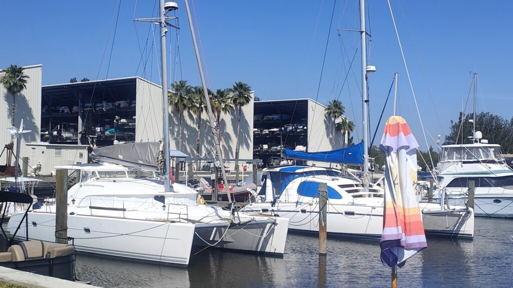
There was nothing to do except turn around and ride back where I had come from. Half a mile back in the wrong direction was a marina and waterside restaurant, Dixie Belle’s Grill and Bar, and I remembered that I hadn’t really had any breakfast. I made the decision to stop and get at least some value from this frustrating detour, and it was a good move. They served up a tasty brunch while I admired all of the fancy yachts, including many smaller craft that appeared to be stacked on several levels in what I took to be huge boat warehouses! This country continues to surprise me.
Boat warehouses
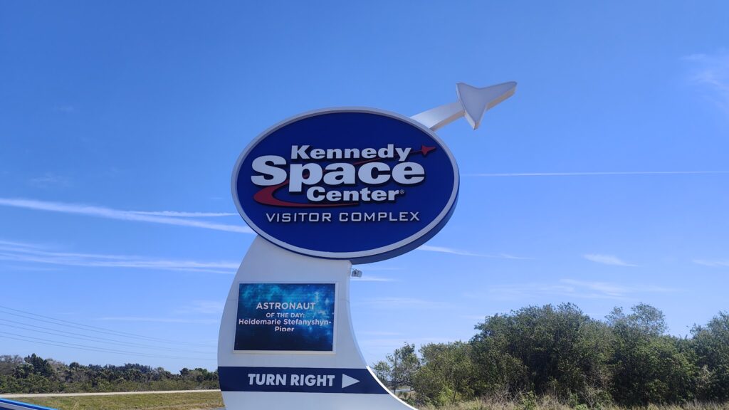
I still had to ride the extra miles and put up with cycling on the shoulder alongside the trucks – and into a strong wind – but it was over quite soon. Where the roadside pavement came to a very sudden halt, I took the next turn north, which pointed me towards Kennedy Space Center. And that is exactly where, a few miles later on, I found myself, on the closest public road to the Florida coast. I got close enough to see some rocket shapes sticking up into the air, and a sign telling me the name of Astronaut of the Day (really!). I don’t know how you win that particular award, but today’s lucky astronaut was the wonderfully named Heidemarie Stefanyshyn-Piper. Luckily it was a very big sign. They had signs at the visitor entrance counting down from 10 every twenty yards or so; but my business today required me to head elsewhere. So I continued past the shiny new campuses of well known air industry names like Airbus and Lockheed, and headed west into a fierce wind towards the huge NASA Causeway bridge to take me back to the mainland and route one. Turning north again brought almost instant relief.
AOTD
I felt like I had worked hard already today, but I still had 55 miles to go and it was hot. Unless I wanted to add even more miles, the only sensible route now was to stay on, or close to, route one. That made for perhaps the least scenic part of my trip so far and I pretty much put my head down and ground out the miles. There were just a couple of highlights. First, as I was getting hungry, I happened upon a small roadside beer garden. It was really just a shady outdoor bar with stools all around it, next to a small caravan that acted as a kitchen. Two young girls were running things and the customers all looked like they had arrived on motorbikes. It was cheap and friendly and served at least one decent beer and a wicked BLT sandwich. I got chatting to one of the older guys next to me, who was originally from western Pennsylvania, like my wife, Jenni. There was a mutual interest in beer and travel, and the time passed easily. We even drank the same beer: Yuengling (also from PA), which I recommend in a crisis, if you can get it. It comes from the oldest brewery in the USA.
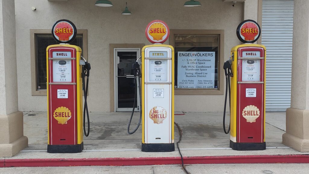
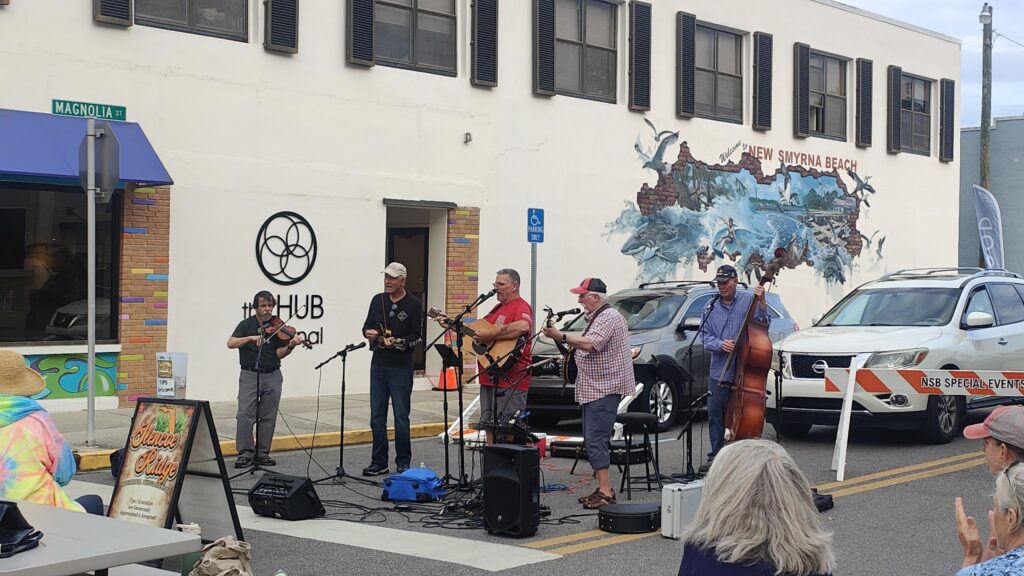
My other highlight came in the very pleasant small town of New Smyrna Beach, towards the end of my day. In the attractive Main Street they were holding a street fair, with all kinds of interesting stalls and a live bluegrass band. It was what I think of as the best of American small town life. On a side street were the preserved petrol pumps of a classic 1960s (or before) gas station that looked straight out of a Wes Anderson movie. All very pleasing.
Accidentally Wes Anderson
I arrived an hour later at my quiet Airbnb in a suburban estate in Port Orange, close to Daytona Beach. This would be my home for two nights and a day while I – and my uncharacteristically sore undercarriage – enjoyed a well earned rest and caught up on unfinished business. And then it would be onward and upward to St Augustine on Saturday.
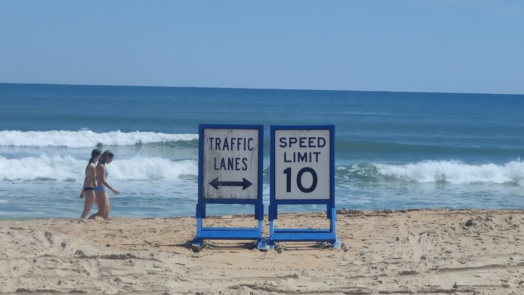
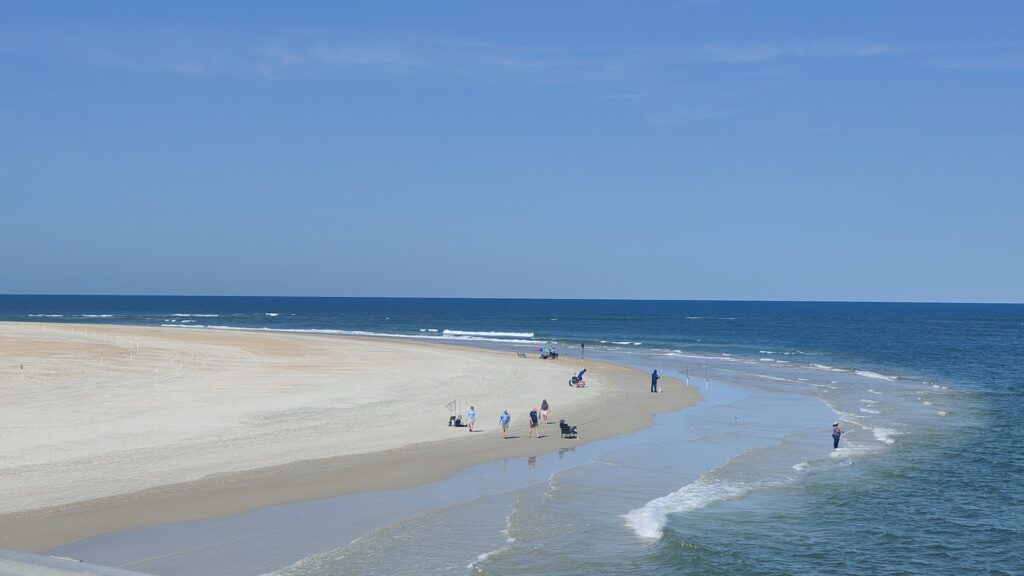
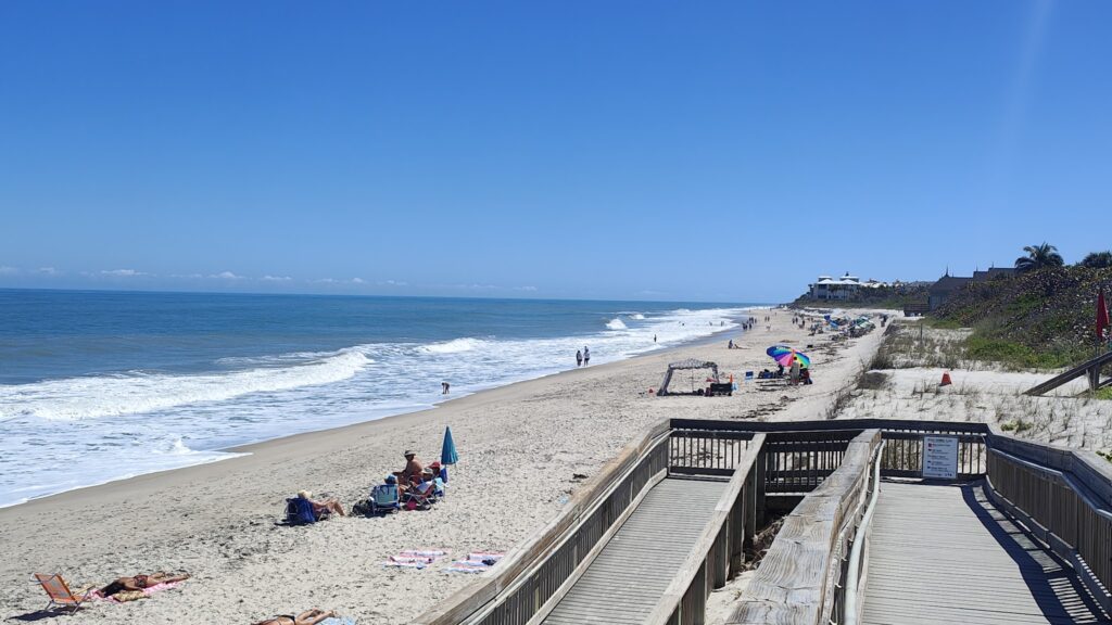
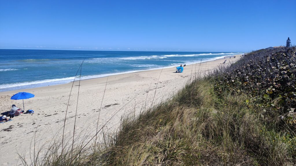
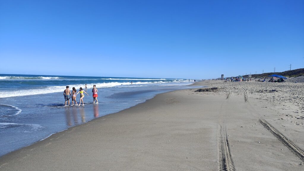
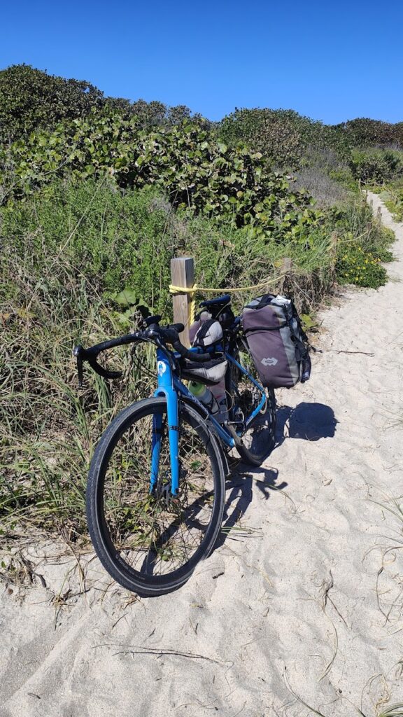
This trip has involved a lot of cycling in a straight line, but today was about as straight as it gets. As soon as I had crossed my first drawbridge, from Fort Pierce onto Jack Island, a long, thin strip of sand dunes and mangrove swamps running north to south, I barely deviated all day. Seventy straight miles of flat now followed, a lot of which looked very similar. Every hour or so I would stop at a beach access point and see what was otherwise just out of sight. The beaches were always beautiful, with white sand, turquoise water and crashing waves. The currents are strong here and there were red flags flying today warning people of the dangers.
You shall not pass
I found a couple of pleasant places for sustenance. One was a small beach cafe with brightly painted wooden tables and benches. The latter, on the shores of the Indian River – the Intracoastal Waterway – was a more fancy German style cafe. It all felt a little incongruous but their apple tart with ice cream and dark German beer was pretty convincing. These places came along quite rarely on a day when roadside development was at a minimum on the islands. I also stopped at a turtle protection education centre. This twenty mile stretch of beach is internationally important for Green Turtles, among others, as a nesting site and there are significant efforts being made to help them. These include a ban on artificial lights within sight of the beaches during nesting season, which starts in May. I also visited an education centre for manatees yesterday. It sits on the shores of the Indian River, closer to much greater human population and widespread boat use. Needless to say, neither of these iconic species are doing as well as they were for the previous 150 million years before humans came along. At least they have some friends.
Beach life
I made a couple of new friends today, albeit briefly. First I was towed along by a local cyclist who overtook me on a very expensive bike, but not so fast that I couldn’t stay on his back wheel. He apologised for not riding further, but I was grateful for the respite from the constant sea breeze. Then, at the turtle centre, two ladies came up and asked if they could talk to me. They had seen my entry in the visitor book where I wrote “Cycling to Boston” and wanted photos with me!
Pure shores
The final part of my ride today took me along the first part of the “Space Coast”, as I got closer to Cape Canaveral. A large military airfield signalled the start of the much larger and busier Cocoa Beach, where I reached the end of my journey, and the end of three days and about 230 miles of cycling mostly up barrier islands on route A1A. The first half of that was notable for its conspicuous wealth. Things had now come down to a level of privilege I was more used to seeing across the USA. It was unthinkable that it would carry on forever. It still amazes me that there is so much opulence.
Family fun
On a more mundane level, however, I was back in the land of fast food and I fancied a Dairy Queen Blizzard. Sadly, they were all out of vanilla ice cream, so that treat will have to wait for another time. It is one of my favourite things to eat in America, and feels iconically American. Since all food and drink is guilt free on a long distance cycling trip, I’m sure that day won’t be far away. But I draw the line at chocolate ice cream… not my thing at all!
The Florida coast continued to provide me with opportunities to cycle directly north along barrier islands, with water on both sides of me, often within sight. The beaches and the turquoise seas were delightful when you could access them; but the beach front continued to be developed almost without a break. During the course of today, the really big, fancy developments gave way to more modest shore residences, and I even saw my first stretch of nature along the sea shore, where a rare piece of coastline had been purchased by the Nature Conservancy.
A common sight
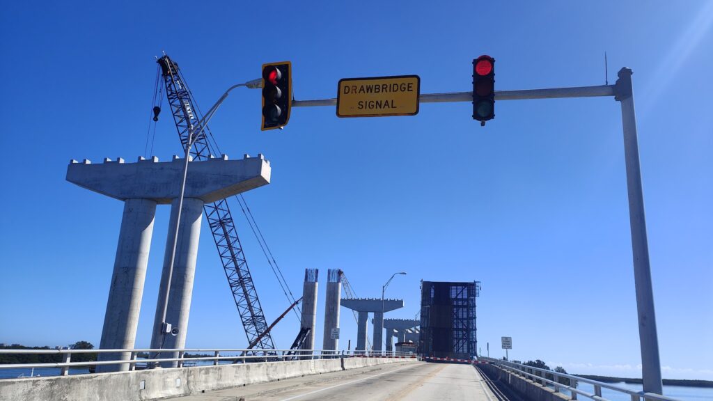
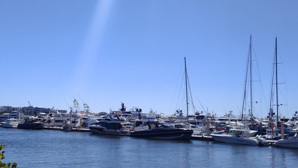
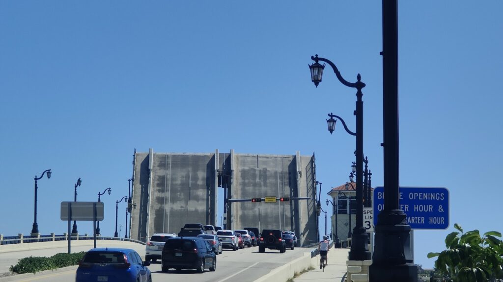
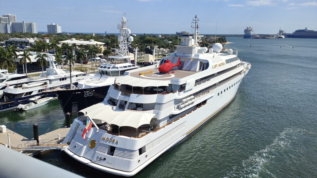
The shore of the Intracoastal waterway was also heavily populated, especially when, after an hour or so, I reached the city of Palm Beach. All along the waterfront here were countless super yachts, costing God only knows how much. There was plenty of activity on the water and the drawbridges linking the islands to the mainland were regularly raised: the one leading out of central West Palm Beach, for example, twice every hour. I just made it over before the lights began to flash. This whole area was dripping with wealth, and contained many incredible waterfront mansions, large enough o be museums. But security here was high, and the sea shore was only accessible directly from the private boardwalks that each had locked gates. This was territory of the most exclusive nature, and not to be shared.
Beach development
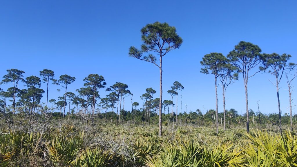
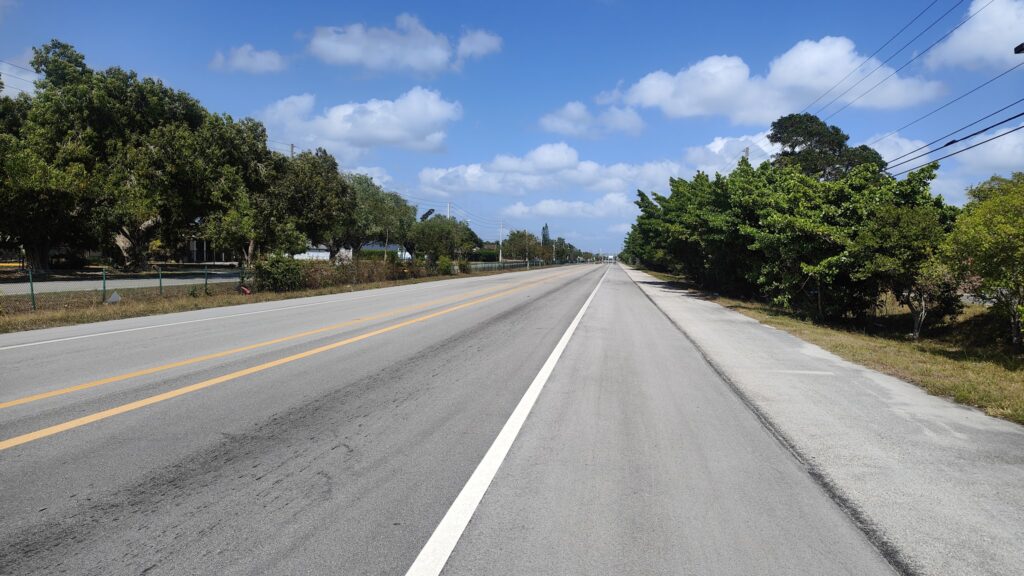
I was well over 100 miles north of Miami Beach before things took on more of an air of normality. I stopped for coffee and then headed north again on a long straight road that gave way to a cycle path through a state park. It was a lucky find, and I felt like I was cycling through a Dr Seuss landscape of arid scrub with periodic tall trees that had bare trunks and bushy tops. I pressed on because this well made path had to lead somewhere, and it did. After a few miles of the busy route one, I was back onto a drawbridge over the broad St Lucie River, and then I found a smaller road that hugged the western shore of the South Indian River for twenty miles, looking across to the islands for once instead of being on them. This delightful road took me all the way to the pleasant town of Fort Pierce, my destination, which I reached as the sun was setting.
Trufula trees
Fort Pierce was also my first encounter of this trip with train lines and – more evocatively – that plaintive wail made by the goods trains, heard all over America on their vast, slow journeys. It was a sound I had missed: these enormously long freight trains were my regular companions in 2023, and I was glad to be reacquainted. It represented a side to the country I identified with much more than the super rich – albeit in their stunningly well manicured surroundings. It is mostly lovely to see; but they can keep it.
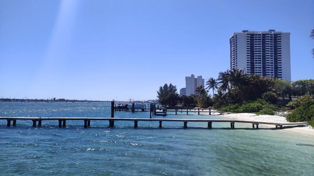
The city of Miami Beach lies on a barrier island separated from the mainland by the broad expanse of the Intracoastal Waterway, a network of broad lagoons and lakes that provide a continuous route for large vessels right up the east coast of Florida from Miami northwards. A whole series of different barrier islands are linked to the mainland and, sometimes, to each other, and my way ahead took me along many of them, following the many miles of glorious, sandy beaches. It meant crossing a lot of swing bridges, which was the only chance I had to cycle up of down hill!
Miami Beach cycle path
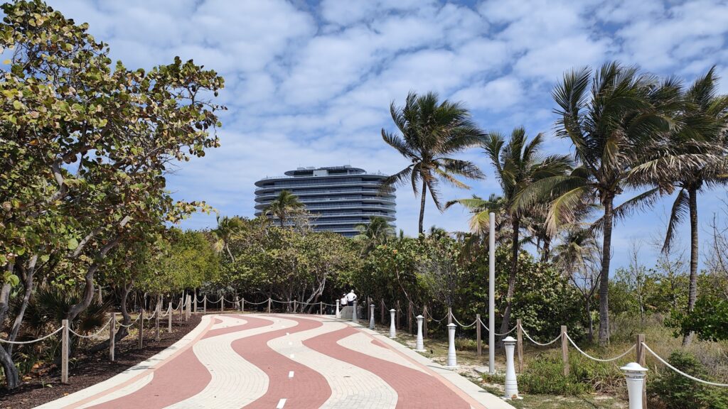
On many of the barrier islands, you are only a matter of a mile or less from water on both sides. There is almost continuous beach front development for more than a hundred miles to the north of Miami, and much of it is quite exclusive, with private beaches. In other places, such as my first ten miles today, there were well made bike paths all along the shore, and people out taking many forms of exercise alone or with companions. For some people here, fitness seems to be a big part of life. There are outdoor gyms, cycling, walking and running, and all manner of beach activities, including volleyball.
Volleyball
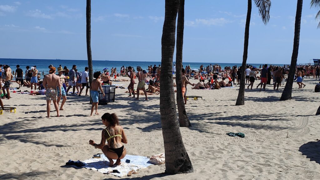
The route along the coast was only interrupted around Fort Lauderdale airport and sea port, where it became rather scrufffy and industrial for a few miles. But then I was crushing Fort Lauderdale beach – the most traditional promenade ai have seen – where the beaches were crowded with many young people this St Patrick’s Day. I’m not sure I have ever seen so many young people on a beach all together as right here today. Quite a sight. They seemed to be having a lot of fun.
Beach life
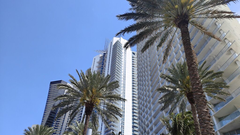
Later I cycled along the coast in upmarket Boca Raton, where the Ocean Drive was a series of sumptuous, older villas, mainly built in an ornate mock Spanish style. They were in manicured grounds and there were no stopping points along this section of coastline. I can’t imagine the wealth you need to live here. It seems to extend to the ownership of luxury yachts, however. Even in the more modern developments, there were endless rows of high rise residences and hotels lining the beach front. Several bore the name Trump. More still had artificial waterfalls cascading down to their driveways, rather like Las Vegas casinos. It was all tasteful, in some cases even attractive, but the overall effect was one of quite unnecessary privilege.
Sunny Isles Beach
However you look at it, this corner of America simply drips with excess wealth. I have been lucky enough to travel the world widely, and see and even experience real privilege, but despite previous trips even to places like Monaco, the sheer scale of this wealth here has surprised me. It has been a cycling trip like no other so far. But I cannot deny that it is very beautiful in its own way. How much more could there be of it?
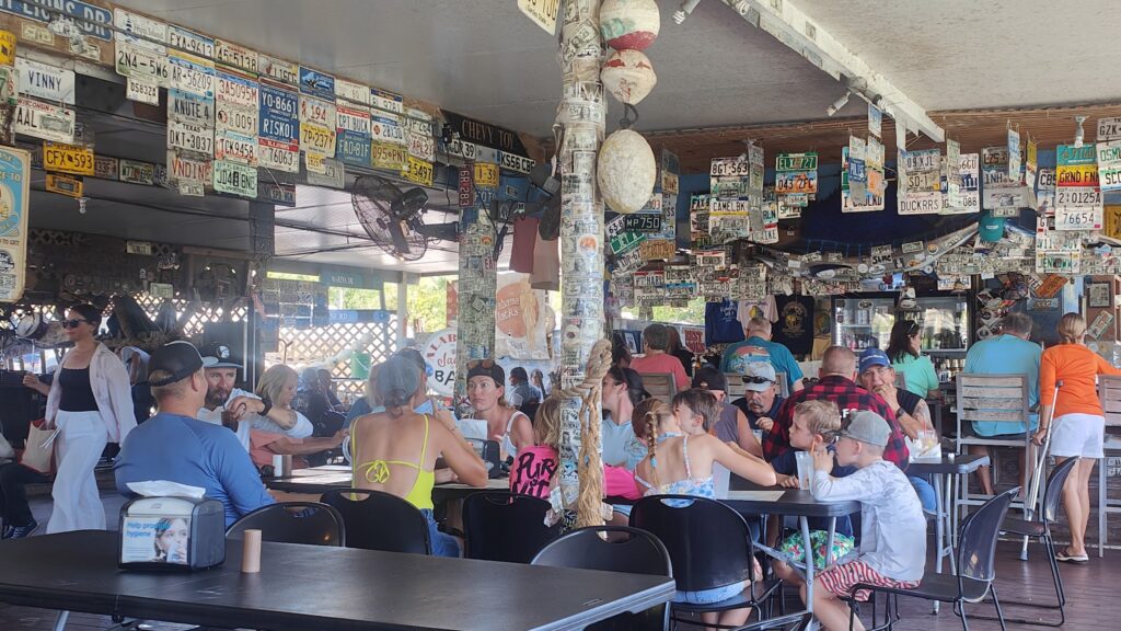
It was really hot today. The wind was more in my favour, but it got pretty stifling as the day wore on. I left behind the Florida Keys after an hour and headed off on the only available road that avoided busy route 1. And that took me up the coast and into the mangrove swamps. Here all development came to an end, and for miles it was just a long, straight road and trees on either side, masking the nearby presence of water, except for the occasional bridge or roadside canal. In the midst of all this was Alabama Jack’s, a great waterside lunch spot where everyone sat outdoors under shade, and all kinds of people, including boaters and many motorcyclists, all mingled under the same roof. It was decorated with hundreds of license plates from allover America and had a unique atmosphere. Perfect place for a shrimp salad.
Alabama Jack’s
Then I was off again, and into the most monotonous part of my ride so far. In another hour I reached the unremarkable Florida City, and from there it was a straight line for an hour or more towards Miami along a dedicated busway, which had a cycle path running alongside. It was a huge, wide expanse of tarmac and you could have landed a Jumbo Jet on it. Probably. It contained very few buses today. But it got me to the edge of Miami proper in an efficient way, missing out on miles of uninspiring sprawl.
Busway
After that. I picked up Old Cutler Road, which wound its way just inland of the elusive coastline, through shady avenues of old trees, past beautiful homes in mature grounds. There was a lot of it, and it marked the start of perhaps 100 miles of continuous, exclusive coastal development. However this part of Miami had an older feel to it, where the excessive wealth was a little more concealed in very private surroundings. It was all lovely to cycle through, and a big change from the busway! The only issue was the mature tropical tree roots that caused regular bumps in the surface of the path. On only my second long day of cycling in months, this was not they treatment my sensitive undercarriage wanted!
Bumpy bike path
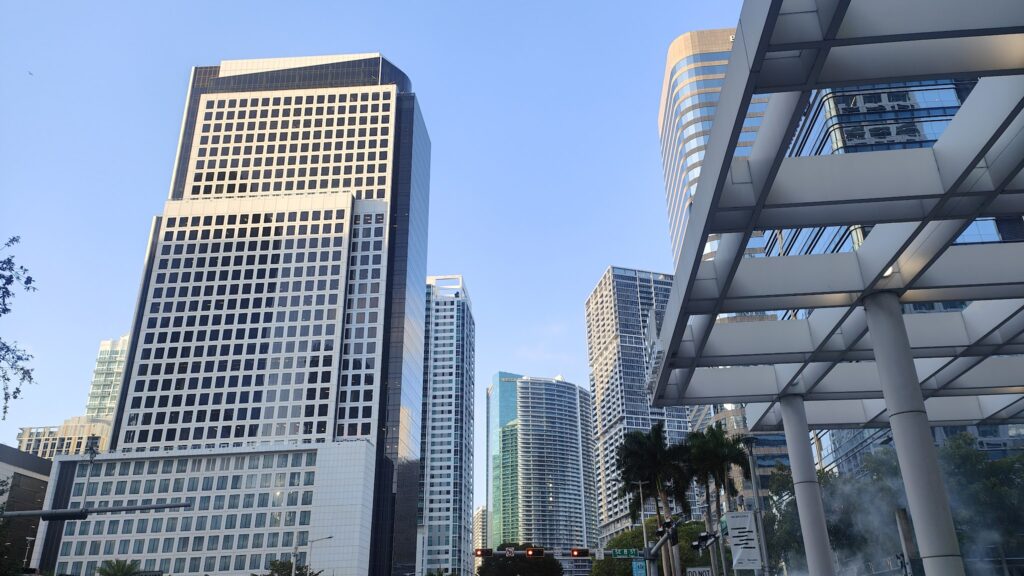
I made barely a turn from the roadside cycle path on Bike route 1 North, and it delivered me suddenly into the throbbing heart of downtown, where many sleek new buildings suddenly reared up all around. It was an exciting part of the ride and it was both impressive and large. This is a big city with a feeling of both wealth and importance, a meeting of cultures and a huge port as well. But it was among the more attractive modern city scapes I have seen, with a predominance of white and green mirrored towers in unusual shapes and orientations. There was a lot to take in. And then, suddenly, I was crossing a swing bridge – a reminder that boats and water play a big part in the layout of the city. There were plenty of fancy sailing craft out on the water today, a late Sunday afternoon. The place was buzzing.
Downtown Miami
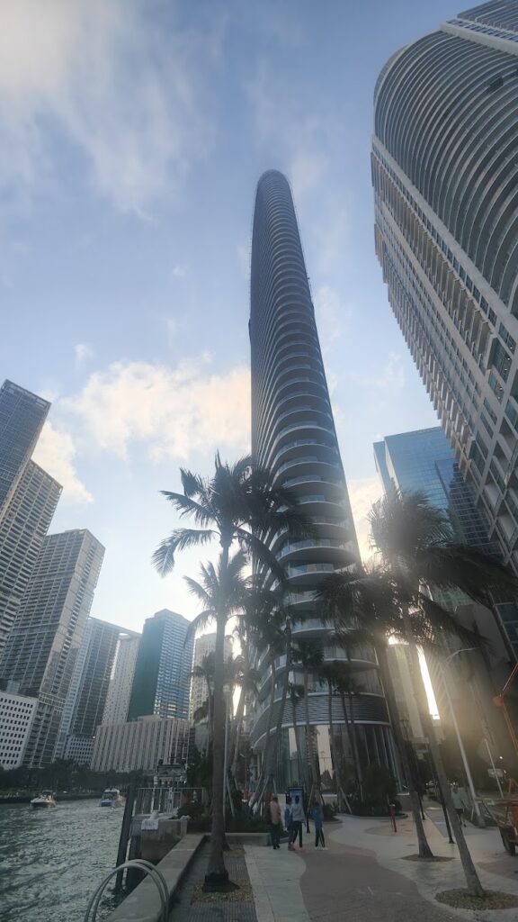
From downtown Miami I crossed a long causeway, via a few smaller islands, to reach the oceanfront of a Miami Beach, which stretches for miles and is lined with a collection of fine Art Deco buildings, along with some more modern, larger hotels and condominiums, which were all very tasteful. The beach here is a vast expanse of fine, pale yellow sand and it stretches away to the north for many miles. I was staying in one of the larger Art Deco buildings, now a very cool hostel called Generator Miami. I had stayed when I first arrived off the plane from Colombia, and found it such good value and pleasant to be around that I came back! I ended my day with a sunset swim in their beautiful large pool in the gardens behind the hip lobby. A day that started slowly but rose to quite a climax.
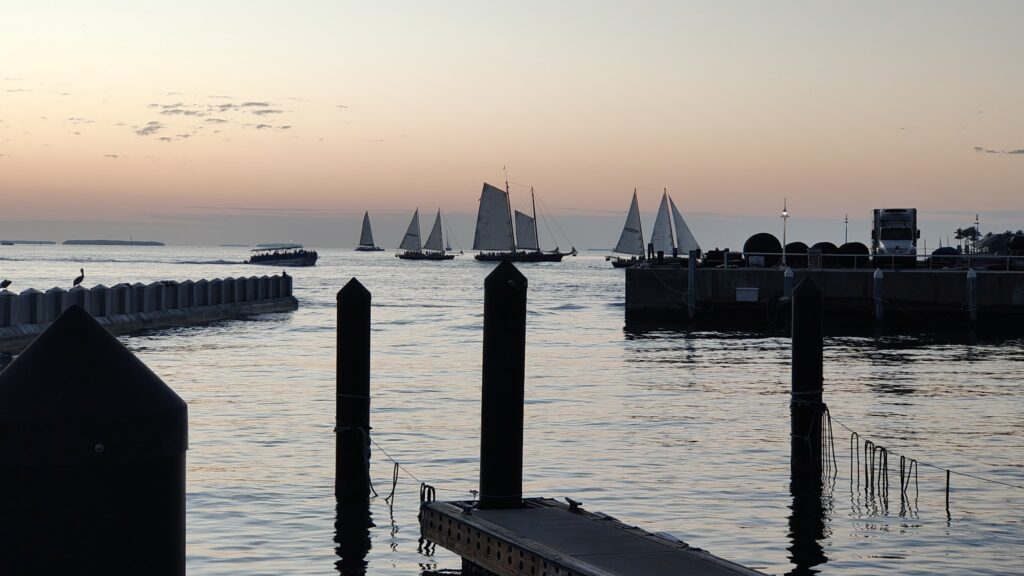
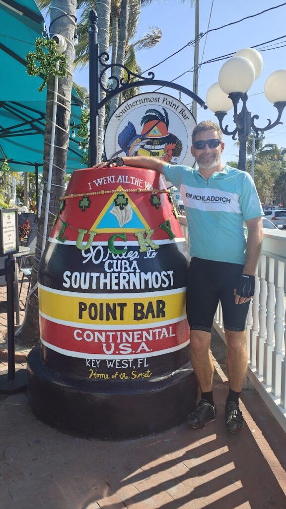
You can’t get further south in the continental USA than Key West. It sits at the bottom of a long chain of islands: the Florida Keys. They trail off south west from the bottom right corner of Florida, below Miami, for over 100 miles, into the newly renamed Gulf of America. Happily none of the signs I saw reflected this name change, so neither will I.
Southernmost point
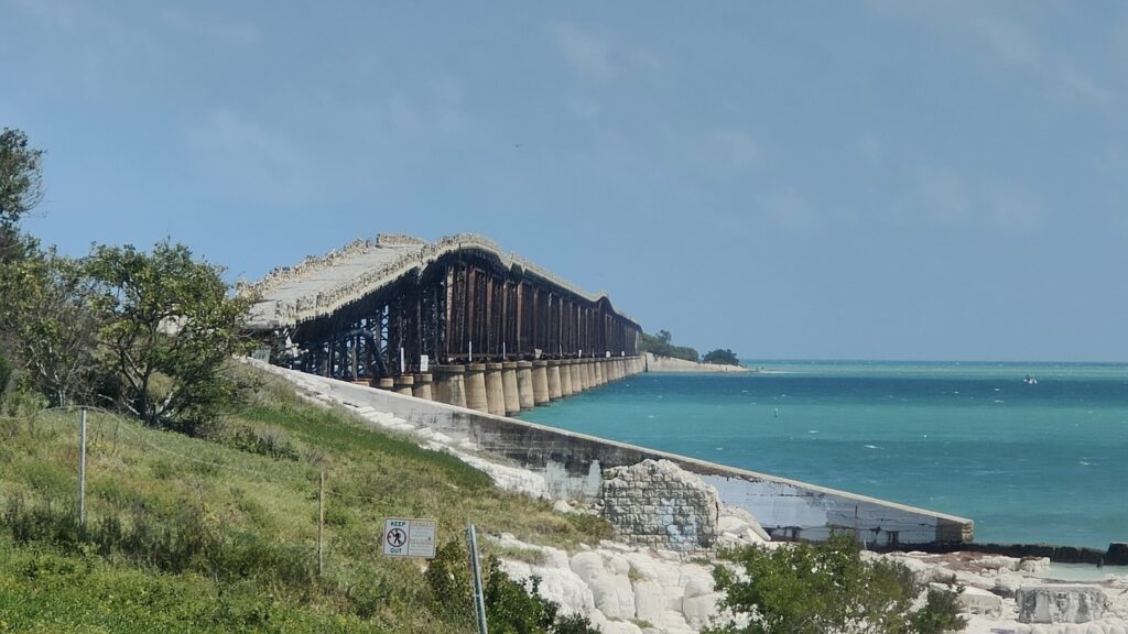
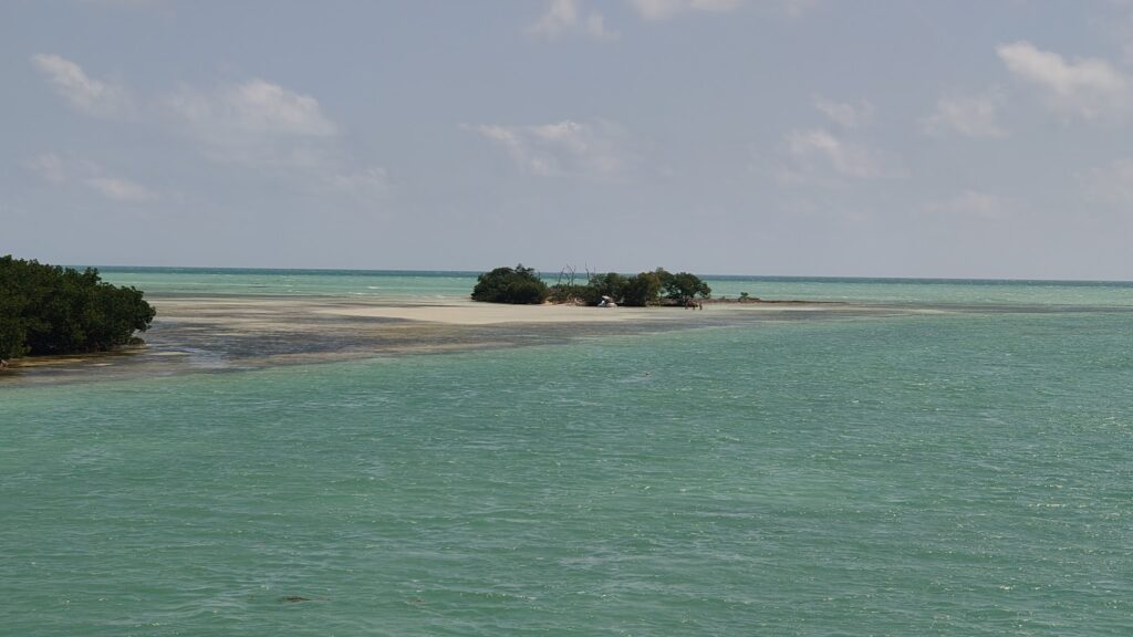
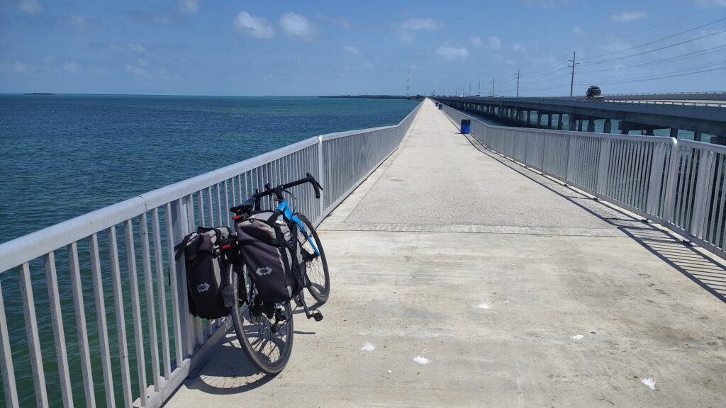
US Route 1 joins all of these places together, a ribbon of tarmac from which it is often possible to see both the turquoise waters of the Atlantic Ocean and the Gulf of Mexico simultaneously. It runs where there was once a railway, built to open up Key West to the rest of Florida. In places you can still see the huge old bridges that crossed between the islands, but much of it is now rusting away and unsafe or even incomplete. It must have been a major achievement in its day. Today, there is a stream of cars running in each direction, but also – for large portions of the way – separate cycle paths. There are a few big bridges, most notably Seven Mile Bridge, where you have no choice but to cycle along the broad shoulder of the highway, hoping that all the vehicles stay on their side of the white line. You have to avoid the shredded tyres and other detritus, including two worryingly beaten up cycle helmets. I hope their owners came off better.
Old train bridge
But the biggest challenges I faced on my 95 mile ride out of Key West were the unhelpful sea breezes in my face and the relentless heat. It was about 28 celcius today and there wasn’t much shade. It was energy sapping. And this is March.
I wouldn’t quite say that the bicycle is king in Key West; but it is definitely a senior member of the royal family, perhaps a Camilla Parker Bowles. You could argue that cockerels are king, in fact, because they seem to run free all over town. It is that kind of place. BIkes are everywhere, however, and commonly used to get people of all types around town. Taking on something on the scale of my ride, however, was a very different prospect. I was slowed down from departing by the US postal service. I wanted to to send a box of belongings, mostly clothes I had with me from my trip to Colombia, to an address in Philadelphia. I boxed them up on Friday evening but couldn’t send them until the office opened at 9.30am. When I got there, the queue was enormous and there was only one person serving. So I got away late and found myself riding against the clock on the very first day of my adventure.
Tropical paradise
There were some quite long stretches without anywhere to stop. When I could, I stopped at a couple of small grocery stores and a gas station for much needed fluids, consumed in their air conditioning, and a seafood restaurant for lunch, where I had a conch burger. Otherwise I just cycled and took a few pictures. It was a rude awakening after a few months out of the saddle. But a memorable, often very beautiful, and altogether unique cycling experience. I was glad when my 95 miles were over, by which time I had my lights on after a lovely sunset. It may have been a flat ride, but it was relentlessly hard work without any respite.
I arrived at my Airbnb to be treated fully like a king – nothing less this time – and was fed dinner and plied with margaritas. That was an unexpected treat at the end of an unforgettable day. Needless to say I slept very well.
I promised to provide some numbers about the epic trip I just completed. It’s a fiddly business; but below is what I have found out.
OVERALL TOTALS (Boring to Dull via Iceland):
50 days of cycling (52 days from Pacific coast)
Miles cycled: 3861 (from Pacific coast)
Feet of ascent: 108,648 (from Pacific Coast)
Time in the saddle: 296 hours 40 mins (from Pacific coast)
Average miles per cycling day: 74.3
Average speed: 13.0 mph
MILAGE BY REGION:
NORTH AMERICA – 3,716 (45 DAYS)
(of which USA 3,459 miles over 42 days and CANADA 257 miles over 3 days)
ICELAND – 145 miles (3 DAYS)
SCOTLAND – 223 miles (4 DAYS)
For a more detailed breakdown week by week, I have copied in the table below from a spreadsheet. I would point as a highlight to 21 to 27 August, easily my most prolific week, when I averaged 104.4 miles each day at a speed of 14.3 mph in extreme heat. After that, nothing was quite so challenging until I was defeated by the Icelandic wind and took evasive action in the face of cataclysmic Scottish rain, when an ark might have been of more use.
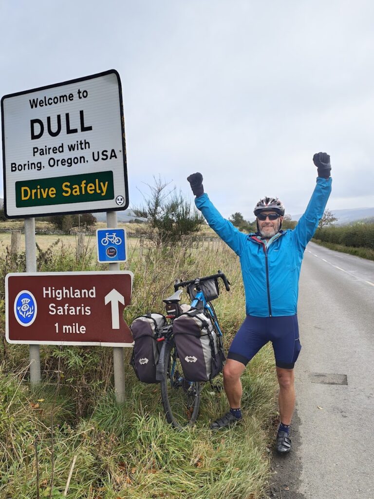
Today was an auspicious day. 12th October 2023 marked the tenth anniversary of the first celebration of Boring and Dull Day. What better time, then, to be arriving at the culmination of my long and almost certainly unique cycling adventure. We had 22 miles left to go and a fine, if rather cool Scottish morning in which to enjoy the magnificent scenery.
Things got off to a start in Killin, our last overnight stop, where we stayed in a rambling old hotel beside the River Dochart. It had plenty of character. The lift, serving all five floors, was at least 100 years old. If you treated it nicely, and fully closed both mesh doors, it would deliver you to your room in style. Long may it live on. The breakfast was impressively large and wide-ranging and on another day I might have seen that as a challenge. But today I had an early lunch appointment and I held back. A little.
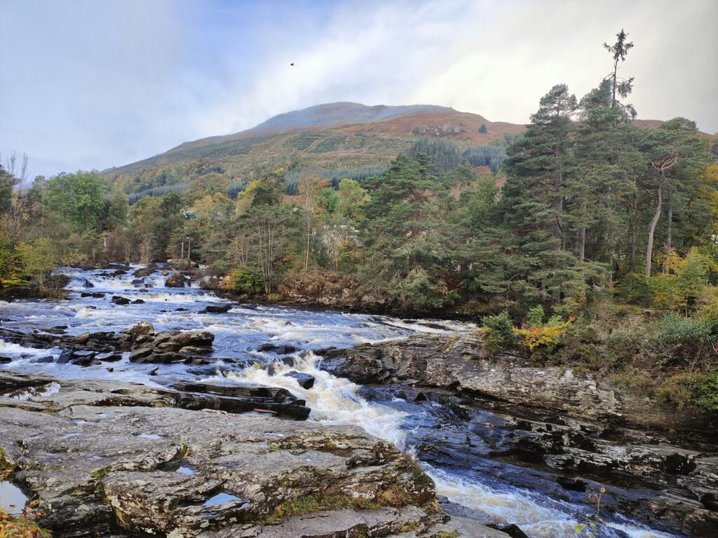
Killin is a pretty place. Jenni, who has spent less time than me in these parts, thought it was reminiscent of a Lake District village. I could see what she meant. It was indeed “a bit like” Coniston, if you’ve ever been there. Right down to the tall shop fronts and the dark green paint. But Killin is quieter. Our hotel was busy enough with retired folk up for a walk in the mountains, or so it seemed. The main draw in the village, however, is the Falls of Dochart, just above the point where the main road crosses an old, narrow stone bridge. It is less a waterfall and more a series of cascades and frothy channels where the river churns its way through narrow gaps in the rock. In the past, I have watched children – including my own – play safely on the rocks here, hopping about in between the various streams. But today, after all the recent rain, it was a raging torrent of dark, fast moving water. Impressive, but no playground.
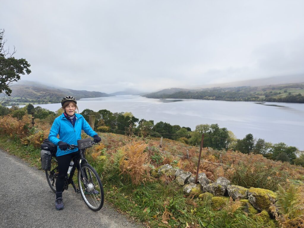
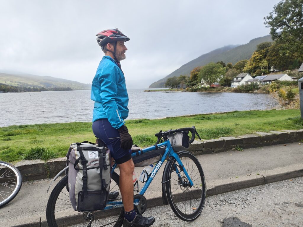
Our ride today took us along the southern shore of the extensive Loch Tay, on a tiny lane that described itself as cycle and walker friendly, which it was, except when an occasional motor vehicle came along in between passing places. The views out across the water and over to the mountains on the opposite shore a mile or more away were never boring or dull, even today when the cloud remained stubbornly low on the mountainsides. I knew they were there because I have seen them before. And they are big. A year ago, I rode along here in the sunshine on my way from Oban to Aberfeldy, one of many wonderful days criss-crossing the Ordnance Survey maps of Britain (in numerical order). But that was in the early stages of another adventure. Today was about reaching the finish point on a single west to east line, spanning two continents. I was very close.
Our cycle-friendly lane undulated along the banks of the Loch for perhaps 18 miles, passing some amazing Grand Designs- style properties with exceptional views and eco-friendly living roofs. Eventually, it reached the eastern end of the lake and the village of Kenmore, whose whitewashed buildings and small marina sat prettily by the water, looking up the length of the loch with the misty mountains tentatively emerging on either side. We passed an old hotel and crossed a fine stone bridge over the broad, fast-flowing River Tay as it emerged from its lake. And hereafter, we stayed close to its banks, all the way to Dull (and indeed for 20 miles beyond to catch a train).
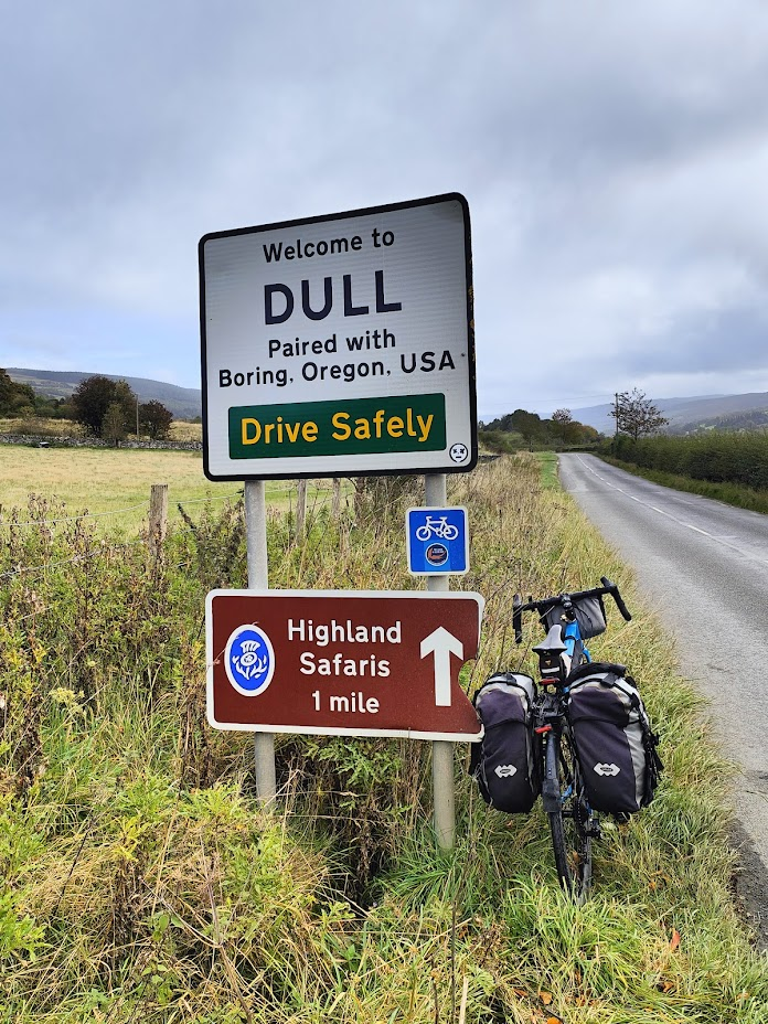
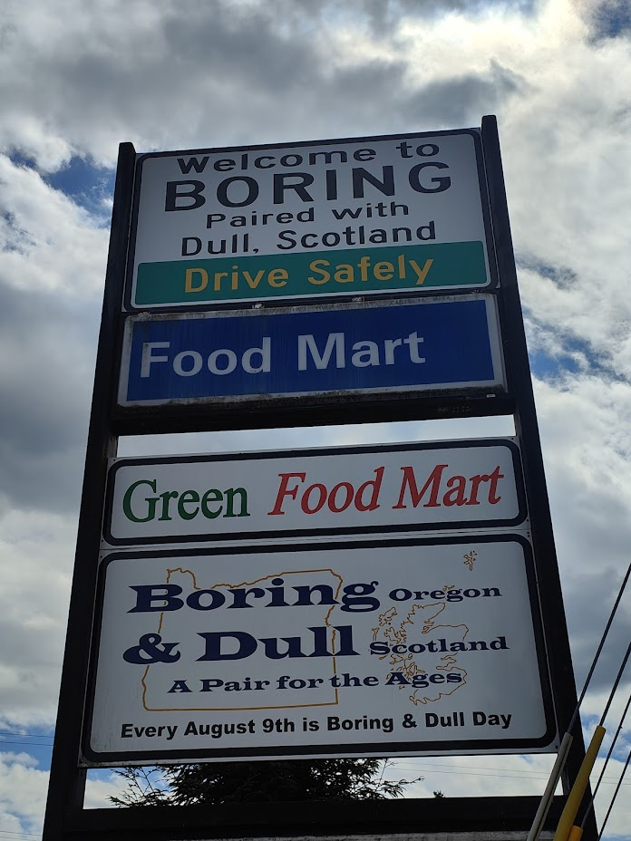
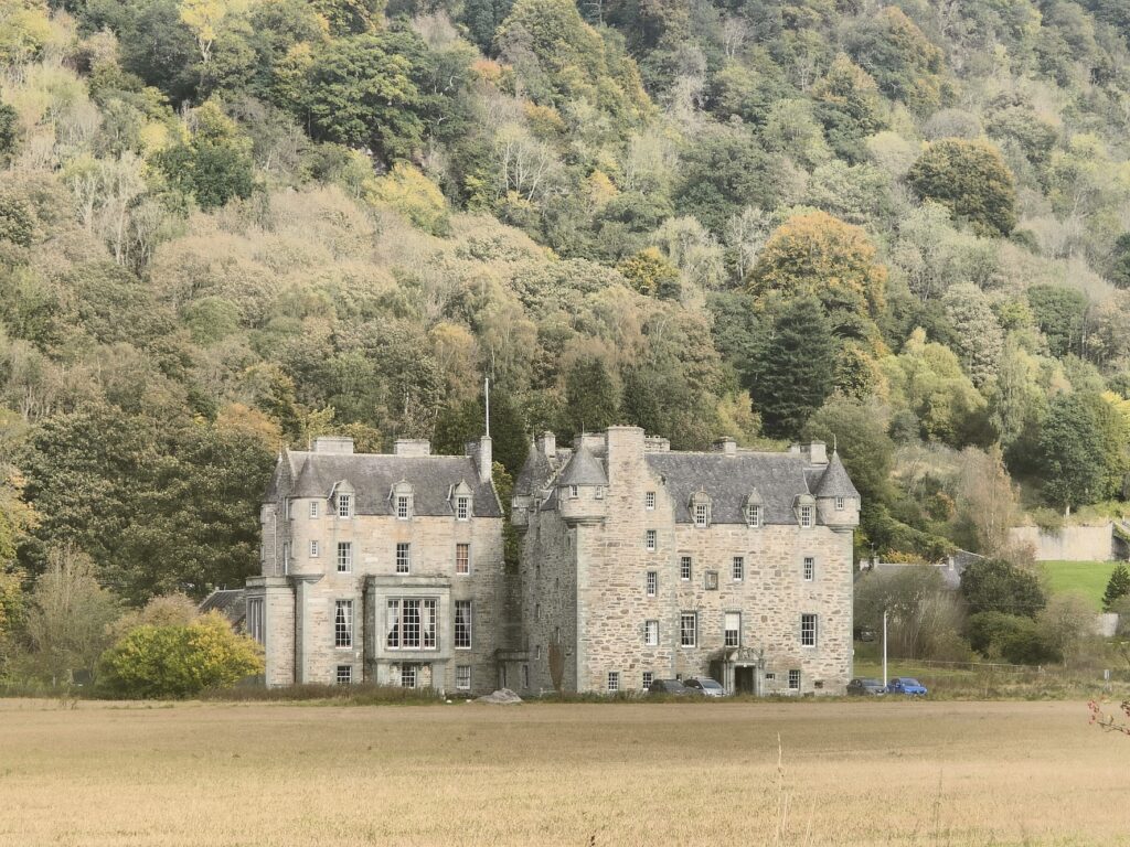
We were now in countryside that was filled with large country estates and castles, with the associated lodge houses, mature trees and estate villages. It was very attractive. The road was quiet and we sped along, mindful that we had an appointment to keep. And then, suddenly, there it was by the roadside: the “Welcome to Dull, Paired with Boring, Oregon, USA” sign. We weren’t yet in Dull, not quite, but the tiny village of Dull, such as it is (population 80), lies a little up the valley side on a quiet lane and nobody would see the sign unless it was here, close to the turning.
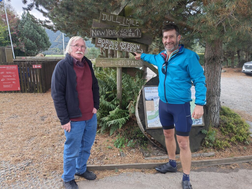
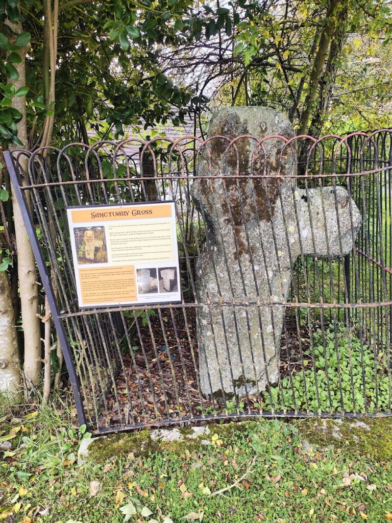
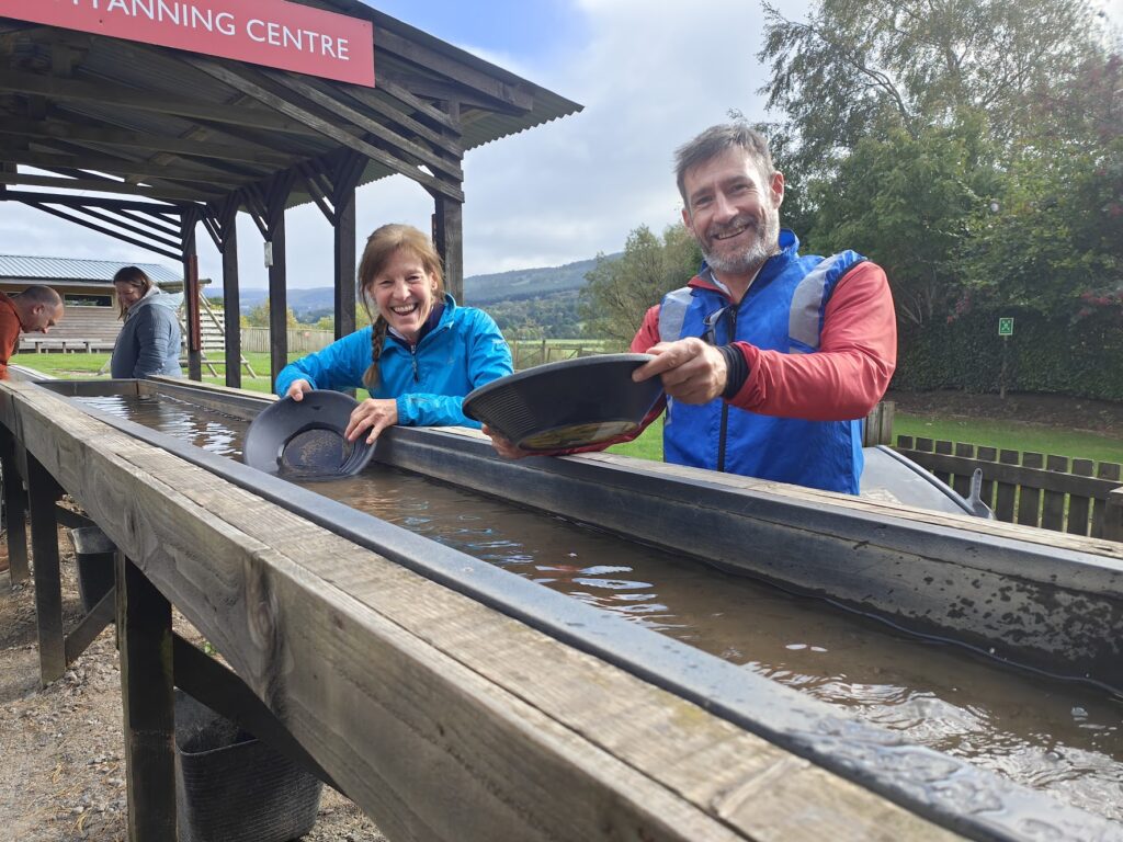
I paused for the obligatory photographs and then we toured the small collection of buildings, sitting quietly by the old chapel and the ancient Sanctuary Cross. It felt like a nice place to live, if you don’t mind being a few miles from local shops and services. There is one business to visit in Dull, however: Highland Safaris (which was signposted from much further away than Dull itself). And that was where we needed to be in three minutes time!
Luckily, since Dull is not large, we made it, and as we climbed off our bikes a grey haired man with a fine moustache called to us across the car park. It was Tommy, lifelong Dull resident and my best and only contact here. We went inside the cosy cafe and he treated us to coffee, soup and herb scones. Then we chatted at length about Boring and Dull, how the pairing came about, visitors from overseas and other amusing stories. Tommy was happy to reminisce and we could have stayed and chatted for much longer. An hour flew by. Reluctantly, we had to leave. We had a train to catch. And Tommy had a house to decorate. So we made promises to exchange more information, took more photos (of us pretending to pan for gold!) and waved goodbye.
The ride down the Tay valley continued to be a delight. Dull is in a beautiful location. And we will surely return. The nearest train station is at Dunkeld and we were delayed just short of arriving by a closed cycle path. There was no way past the high fences keeping people away from storm-damaged trees. The only alternative was a small and rather hairy riverside path next to the swollen, angry River Tay: tricky stuff, and we shouldn’t have made the train. But it was running late, so we did! Seamless, as ever. Just the way I like it. By the end of the evening I was catching up with my little brother in a convivial pub in Edinburgh.
And that was that. Another grand adventure completed. What next? I don’t know. But watch this space in the next day or so for some final trip statistics and reflections on Boring to Dull.